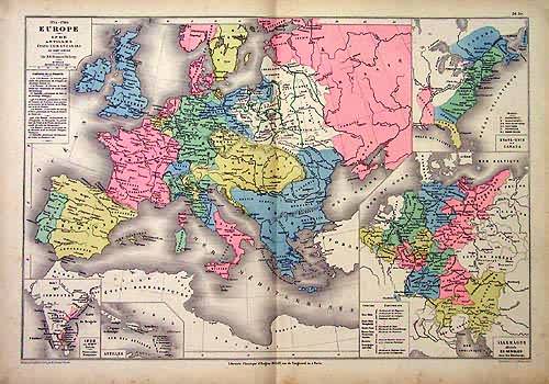
1715 – 1789 Europe
In stock
This colorful map was originally printed in “Atlas Universel et Classique De Geographie,” published in 1881 by Claude Joseph Drioux. Regions are distinguished by muted pastel colors. Railroads, major roads, rivers, lakes, mountains, and the names of empires, provinces, and important cities are identified. Includes insets of: India, Antilles, Germany, and Canada
Size: 17 x 12 inches
Condition: Very Good - age toning
Map Maker: Claude Joseph Drioux
Coloring: Original Hand Coloring
Year: 1881
Condition: Very Good - age toning
Map Maker: Claude Joseph Drioux
Coloring: Original Hand Coloring
Year: 1881
In stock


