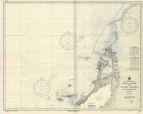
Improvement of Saint Johns River, Florida 1889
Out of stock
Improvement of Saint Johns River, Florida 1889; showing the sites of the North and South Jetties and progress made in their construction to June 30th 1889. Surveyed (May 6th – June 10th, 1889) under the direction of Captain W. M. Black, Corps of Engineers, U.S.A. by J.B. Bacon and assisted by E.F. Smith, Philip Prioleau & Otto Bie. This map is accompanied by a note that details what the different lines indicate as to soundings and depths. Along with soundings this map also features Mayport, the U.S. Reservation, Pilot Town, Fort George Island, location of the Wreck of Delaware and Haulover Cut.
Size: 26.25 x 17.5 inches
Condition: Very good
Map Maker: U.S. Corps of Engineers
Original Production Year: 1889
Coloring: Black & White
Year: 1889
Condition: Very good
Map Maker: U.S. Corps of Engineers
Original Production Year: 1889
Coloring: Black & White
Year: 1889
Out of stock


