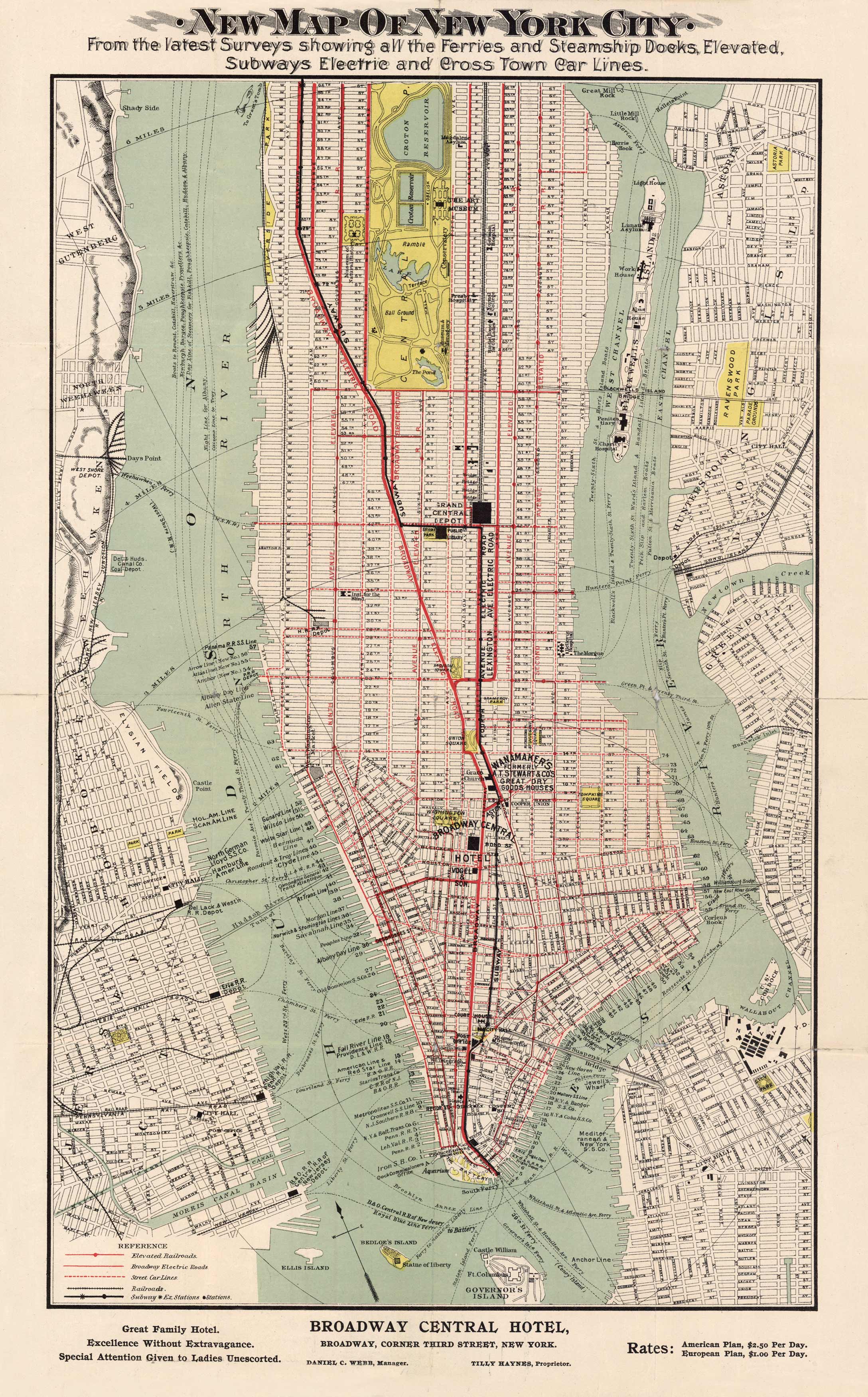
New Map of New York City
Out of stock
This map of New York City shows all of the ferry lines, steamship docks, electric subways, and crosstown car lines around the Broadway Central Hotel. The map also shows the light house, the reservoir, parks, a ball ground, Charity Hospital, Grand Central Depot, Ellis Island, the Statue of Liberty, Elysian Fields, and more. Rates, as labeled, for the Broadway Central Hotel are: American Plan, $2.50 per day, European Plan, $1.00 per day. Great detail of all piers and Ferry routes. All subways and electrified above ground tracks shown.
Size: 12 x 19 inches
Condition: Very Good
Map Maker: Broadway Central Hotel New York
Coloring: Original Hand Color
Year: 1910
Condition: Very Good
Map Maker: Broadway Central Hotel New York
Coloring: Original Hand Color
Year: 1910
Out of stock


