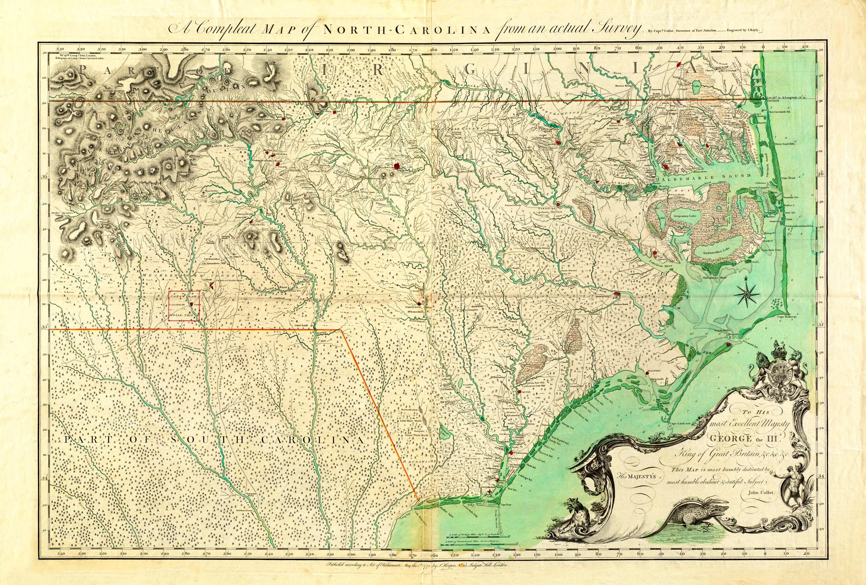
This map spares no topographic detail; it carefully names roads, swamps, rivers, lakes, county lines, meadows, ferries, Indian tribes, forts, mountain expanses, and islands along the coast. The map extends as far west as the Blue Ridge Mountains in present-day Morganton; as far north as Suffolk, Virginia; as far east as Charle’s Sound in Currituck county; and as far south as Wilmington. This map was the most referenced material of the Carolinas up to 50 years after its publication. In the future, Henry Mouzon would borrow details from this map for his own North and South Carolina map. Artistic embellishments include a scale, a compass, and a cartouche with a cougar, an alligator, and an Indian along its border.
Additional information
| Weight | 0.25 lbs |
|---|---|
| Dimensions | 18 × 26.4 × 0.002 in |
Map Maker: John Collet
Original Production Year: 1770
Original Production Year: 1770


