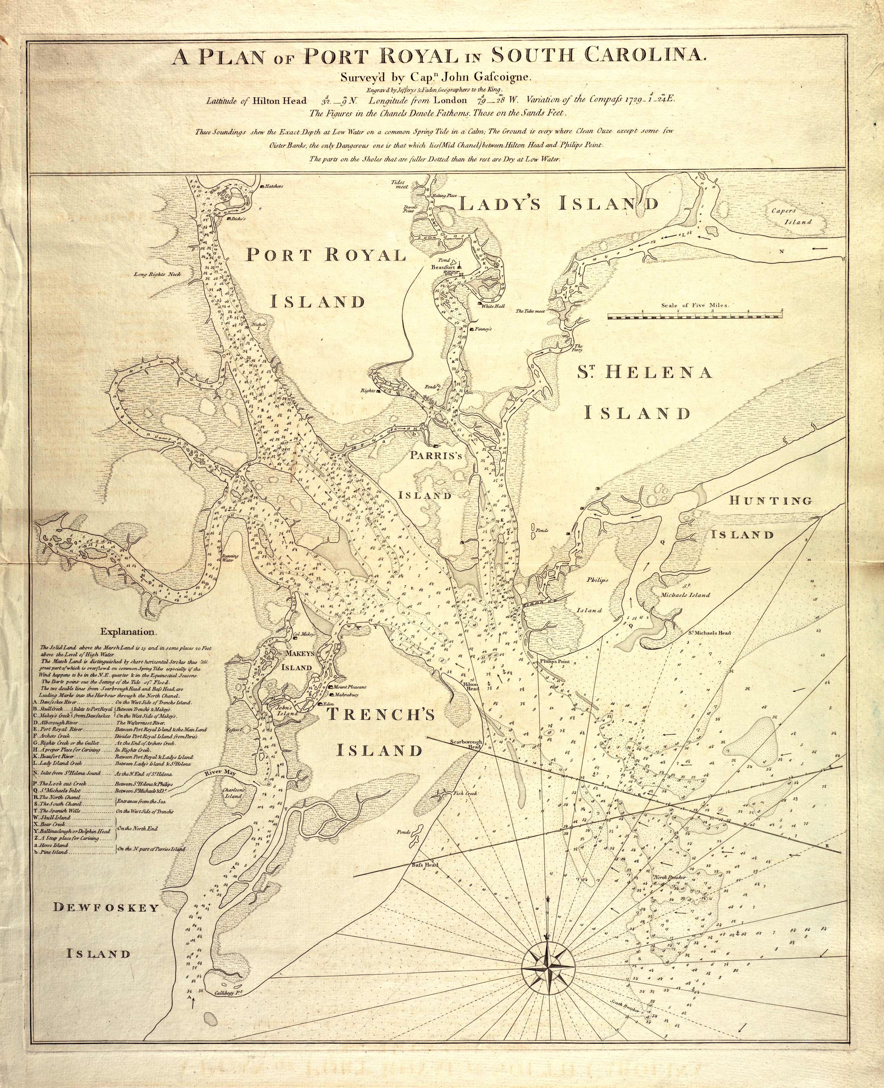
This 1773 map by John Gascoigne details Port Royal in South Carolina. It identifies up to twenty-six islands in the area and various creeks, ponds, and rivers. Published around the Revolutionary War, this is one of the most accurate and informative maps from that time, and it was used extensively to plan battles. The American patriots maintained control of the area early during the war, but eventually, Savannah, Georgia fell under the control of the British in December 1778. The British continued to maintain control of Georgia until the Battle of Hilton Head, where British ships were chased out by the French. The British ended up surrendering, and this location remained an important base for the Americans until the end of war.
Additional information
| Weight | 0.25 lbs |
|---|---|
| Dimensions | 17 × 13.7 × 0.002 in |
Map Maker: Gascoigne, John
Original Production Year: 1773
Original Production Year: 1773


