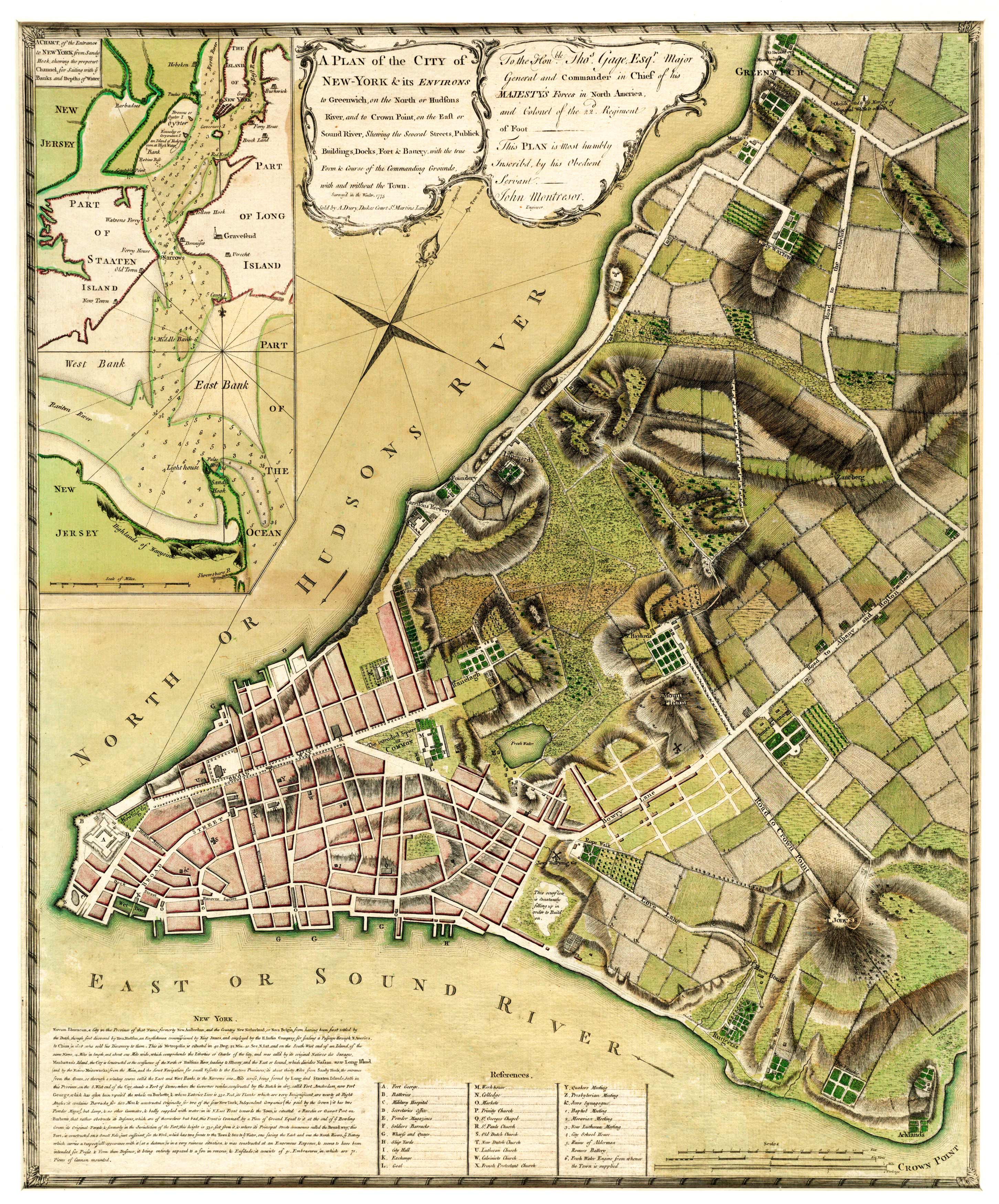
This map names public buildings, streets, and extends from Greenwich to Crown Point. Interesting locations labeled include a brew house, a rope walk, the commons, a ferry house, and a lighthouse. In the lower left corner, the map contains a brief history of New York as related to the East India Company. Extensive topographic information is shown. In the upper left corner, there’s an inset of the entrance to New York from Sandy Hook; the inset shows all the islands.
Additional information
| Weight | 0.25 lbs |
|---|---|
| Dimensions | 3.3 × 2.7 × 0.002 in |
Map Maker: John Montresor
Original Production Year: 1775
Original Production Year: 1775


