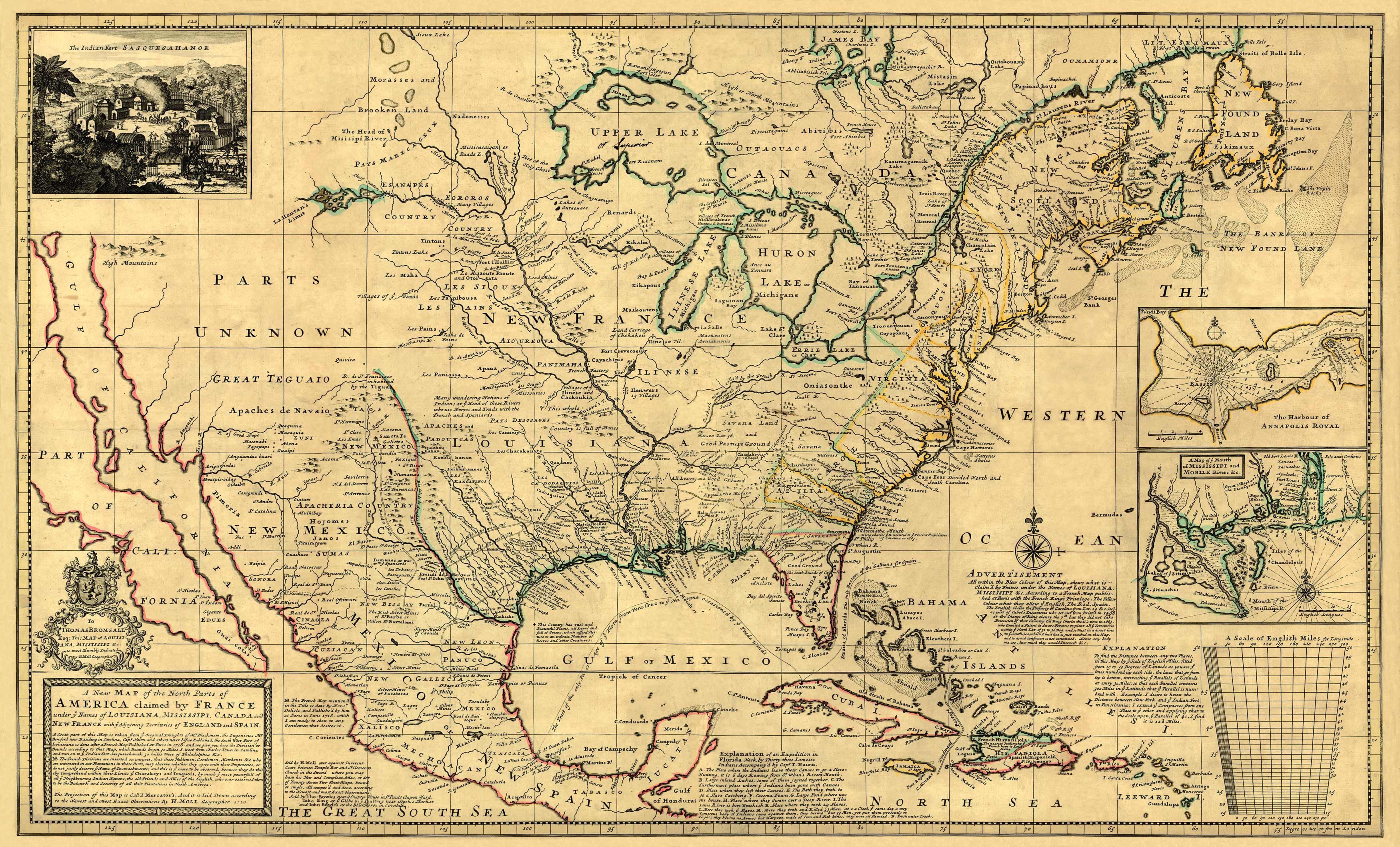
This map is remarkably detailed. On the upper left is a detail of The Indian Fort of Sasquesahanok” which it says is 30 miles East of Philadelphia. On the lower left is the Title and notes on the map construction. Center bottom is an “Explanation” of an expedition in Florida neck. On the lower right are an “Advertisement” explaining the borders of French, English and Spanish claimed lands, and an “Explanatiion” of distances from the scale shown. On center right is a detail of “A Map of ye Mouth of MISSISSIPI and MOBILE Rivers &c” and “The Harbour of ANNAPOLIS ROYAL” in Nova Scotia. There are many other notes and explanations scattered throughout the map, some quite whimsical.”
Additional information
| Weight | 0.25 lbs |
|---|---|
| Dimensions | 14.6 × 24 × 0.002 in |
Map Maker: Herman Moll
Original Production Year: 1720
Original Production Year: 1720


