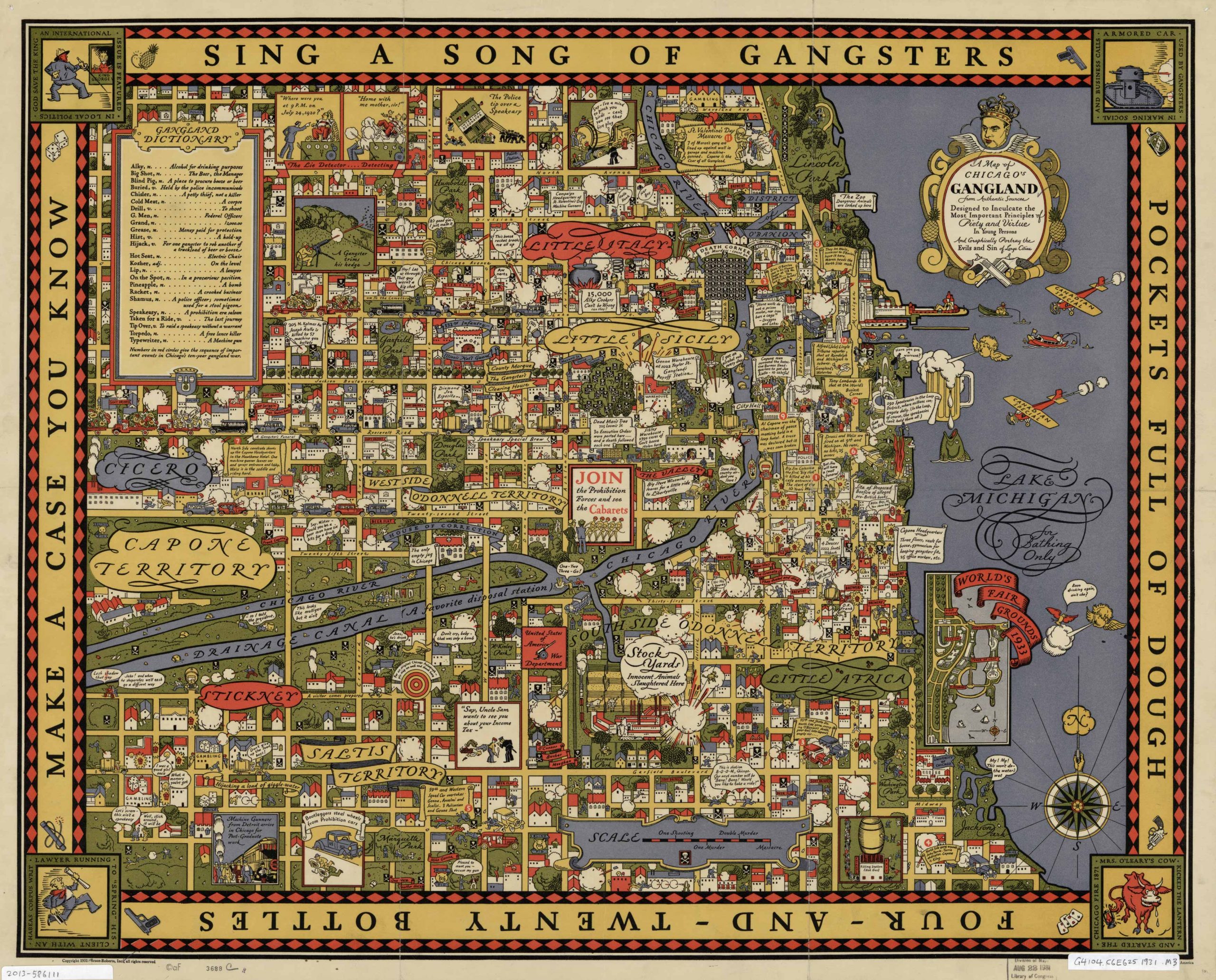
This vibrant pictorial map of Chicago’s Gangland from authentic sources was designed to inculcate the most important principles of piety and virtue in young persons, and graphically portray the evils and sin of large cities. This map was originally printed in 1931 and features areas and indications of things such as: Capone Territory, Cicero, Stickney, Saltis Territory, World’s Fair Grounds 1933, Lake Michigan, Little Sicily, Little Italy, South Side, O’Donnell Territory, among many others. There is also a gangland dictionary and many pictorial representations of Chicago’s Gangland.
Additional information
| Weight | 0.25 lbs |
|---|---|
| Dimensions | 22.9 × 28.5 × 0.002 in |
Town Name: CHICAGO
Map Maker: Burce-Roberts, Inc.
Original Production Year: 1931
Year: 1931
Map Maker: Burce-Roberts, Inc.
Original Production Year: 1931
Year: 1931


