Glossary of Terms
AGE TONING
A pleasant-sounding synonym for browning. See browning.
AQUATINT A
A type of etching in which resin is dusted onto a copper plate. Upon heating, the particles fuse and merge, leaving small portions of the copper still exposed. When treated with acid, a speckled pattern of pits results. Impressions from the plate will approximate a gray tone. Aquatint was occasionally used for maps in the late 18th and early 19th centuries.
BACKED
Sometimes a map is pasted or glued onto another material, such as cloth, to make the map more rugged and durable. Many folding maps and many wall maps were backed with cloth when issued. Maps are sometimes backed for conservation purposes, usually with thin tissue. Archival quality paste and backing material should be employed to prevent chemical deterioration of the paper. This protects fragile maps from further damage from handling. Maps should not be backed when there is no good reason to do so.
BAROQUE
A style of decoration developed in late 16th-century Italy characterized by exaggerated form and extravagant ornamentation. Cartouches on maps from this period were often in a baroque style.
BLEACHING
This is sometimes done to remove stains, or lighten browning. Bleaching almost inevitably weakens paper, and should not be done casually, nor should it be done without regard to modern conservation practices. Excessive bleaching gives the paper a ghostly white appearance that experienced collectors dislike.
BORDER
The printed area toward the edges of a map constitutes the border. In some cases, the border may consist of a simple neat line. In other cases the border may be scrollwork, geometrical designs, or even decorative panels with costumed figures or town views. Occasionally, a map may have no border at all. Do not confuse border with margin. See margin and neat lines.
BROWNING
As the organic material in paper ages, it undergoes a chemical transformation that causes the paper to darken. The early stages of browning may produce a pleasing tone. Extreme browning is often accompanied by embrittlement of the paper. To retard aging, maps should be protected from atmospheric pollutants, contact with cheap paper or cardboard, and from exposure to too much ultraviolet light from sunlight or fluorescent lamps.
CARTA MARINA
A term applied to 16th-century rectangular world maps, usually with rhumb lines.
CARTE A BORDURES, CARTE A FIGURES
A map having decorative panels of costumed figures, views, and the like, at the borders.
CARTOGRAPHER
A mapmaker or geographer.
CARTOUCH, CARTOUCHE
Information surrounded by a border. Cartouches typically enclose the title, the scale, or the imprint. The cartouche may be a simple rectangle or oval, or may incorporate decorative elements such as scrollwork, botanical elements, gargoyles, costumed figures, appropriate scenery, and so on.
CENTERFOLD
Many old maps have been removed from atlases. Often such maps have a vertical fold down the center. Opening and closing the atlas often results in a weakening of the paper at the centerfold, frequently necessitating repair. Browning tends to occur at the centerfold because the paste used to hold the map in the atlas attacks the paper.
CHAIN MARKS, CHAIN LINES
Part of the visible impression left by the wire grid used in the fabrication of laid paper. The chain marks are the coarsely spaced lines running parallel to the short dimension of the original sheet. They are typically about one inch (25 mm.) apart. See also laid lines and laid paper.
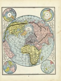
COLORING
Color applied to the map, usually watercolor applied by brush. Coloring generally greatly enhances the appearance of decorative maps, but not all maps were intended to be colored.
COMPASS ROSE
A small starlike device used to indicate direction, often found in combination with radiating thumb lines. A pointer on the compass rose usually indicates North.
COMPOSITE ATLAS
An atlas compiled, often to order, by a map seller from maps on hand. Maps by different mapmakers are often bound together in such atlases.
CONTEMPORARY
Indicates something done at about the time the map was published, for example, contemporary coloring.
DECKLE-EDGED
Used to characterize hand-made paper retaining the original rough edges as produced by the papermaker. Most maps have the deckled edge trimmed off during binding, and deckle-edged maps are considered quite desirable.
DECORATIVE
A decorative map has definite aesthetic appeal. Decorative elements can include animals, sea serpents, mermaids, scrollwork, cherubs, costumes, etc. Many consider the 17th century to be the peak period of decorative mapmaking.
DISSECTED
Cut into sections. This is often done with large maps, which are cut into rectangles and pasted to cloth so that they can easily be folded down to the size of a single section for easy carrying and storage.
EDITION
An edition of a map is determined only by the imprint. If the imprint is changed, then there is a new edition. Obviously, since the plate has been changed, a new edition means a new state. However, a new state is not necessarily a new edition, since the imprint may not have been changed.
ENGRAVING
A printing process employing a metal plate on which has been scratched a design. When ink is applied to the plate, and the plate wiped, ink remains behind in the grooves. A dampened sheet of paper is laid onto the plate and under pressure the inked design is transferred.
ETCHING
A printing process similar to engraving, except that the plate is produced by coating it with an acid resistant material upon which the design is scratched. Acid is used to eat away at the scratched areas, creating the grooves to hold the ink for printing.
FOLIO
A folio book is bound from sheets of paper folded one time. A map from such a book is sometimes said to be folio-sized. Typically, the vertical paper dimension of a folio map is greater than about II inches (24 cm.). Large folio maps would be about 17 to 22 inches (45 to 55 cm.), and imperial folio greater than about 22 inches (55 cm.)
FOXING
Small, usually brown, spots on the paper caused by mold. Foxing often results from storage in damp conditions.
GORE
A section of a globe printed on paper, intended to be cut out and pasted to the surface of a sphere. Gores are usually shaped like an American football.
IMPRESSION
A single copy of a map. For example, if 1,000 copies of a map are printed, there will be, at that time, 1,000 impressions. By this definition, expressions like “second impression” are meaningless, since at this late date, one cannot know the order in which copies were printed. Occasionally, however, it is possible to distinguish between early and late impressions of copper engravings. Copper is soft, and tends to wear. Therefore early impressions tend to be darker, and sometimes-faint lettering guidelines used by the engraver are visible on impressions made early in the plate’s life.
IMPRINT
Information printed on a map giving some combination of the publisher, place of publication, or date of publication.
INCUNABULA, INCUNABLE
Terms used to describe books printed prior to 1500 AD, and also to maps printed before that time.
INSET MAP
A smaller map within the border of a larger map.
ISSUE
All impressions printed at one time without alteration of the plate belong to the same issue. Thus, if two impressions are different states, the plate has been altered and they cannot belong to the same issue. However, an unaltered plate might have been used several times over a period years. In that case, the several issues would all be of the same state. Issues can sometimes be distinguished by the watermark, since different paper might have been used for each issue. For maps from atlases, different issues can often be distinguished by the text on the verso.
LAFRERI ATLAS
A term used to describe 16th-century Italian composite atlases of printed maps. These were apparently often made to order, and contents vary from atlas to atlas.
LAFRERI MAP, MAP OF THE LAFRERI SCHOOL
Terms often applied to Italian maps of the 16th-century, particularly those issued separately or in composite atlases.
LAID DOWN
See backed.
LAID LINES
Part of the visible impression left by the wire grid used in the fabrication of laid paper. The laid lines are the finely spaced lines running parallel to the long dimension of the original sheet. There are typically 25 lines per inch (10 lines per cm.). See also chain marks and laid paper.
LAID PAPER
Handmade paper made by depositing cloth fibers suspended in water onto a wire grid. The grid leaves an impression on the paper, which may be seen when looking though the paper at a bright light. Most maps before about 1800 are printed on laid paper. See also chain marks, laid lines, and wove paper.
LEO BELGICUS
A species of map depicting the low countries in the form of a lion.
LINED
See backed.
LITHOGRAPHY
A form of printing first used for maps early in the 19th-century. The image is printed from a stone or other material on which ink adheres only to specially treated areas.
LOSS OF (PRINTED) SURFACE
A cataloger’s term to describe a map in which a portion of the paper is missing. Sometimes maps lacking printed surface are restored by pasting paper at the missing area on which the design is reproduced in facsimile.
LOXODROMIC LINES
See rhumb lines.
MANUSCRIPT
Handwriting. A manuscript map is one drawn by hand. Manuscript notations are handwritten notes on a map.
MARGIN
The blank area outside the border of a map. Do not confuse margin with border.
MEDALLION
A circular or oval region, usually containing a portrait, sometimes used to embellish maps.
MOUNTED
See backed.
NEAT LINES
The straight, printed lines bounding the map.
OCTAVO
An octavo book is bound from sheets of paper folded in half three times. A map from such a book is sometimes said to be octavo-sized. Typically the vertical paper dimension of such a map is about 8 to 9 inches (20 to 23 cm.). Abbreviated 8vo.
OFFSETTING
When the surface of a map contacts another surface for many years, as in an atlas, there may be a transfer of printer’s ink or color, or a chemical reaction, which faintly reproduces a mirror image of the other surface. Offsetting can even occur from one part of a map to another if the map is folded on itself.
ORIGINAL
An original is a map or view printed from the original plate, block, or stone before it has been retired from commercial use. Sometimes the last user does not destroy the plate or block, and it is later used to make restrikes.
OUTLINE COLOR
Coloring of only the boundaries, borders, or coastlines.
PANELS
Usually rectangular frames around the outside of a map enclosing views, scenes, or figures.
PERIPLUS
A text of sailing directions used in classical times.
PLATE
Strictly speaking, the plate is the object from which impressions are made. Sometimes the plate becomes worn or damaged, and is replaced with a second plate. Impressions from the second plate are sometimes referred to as something like “2nd Plate.”
PLATE MARK
Impressions made from metal plates often show an indentation of the paper extending to just outside the printed area, made when the paper was crushed by the plate during printing.
POCKET MAP
A map that is intended to be folded so that it can be easily carried in a pocket or purse and referred to in the field. These maps are often issued with covers, a slipcase, and supplementary information such as an index.
PORTOLANO, PORTOLAN CHART
A manuscript sea chart prepared for the use of mariners from about the 14th through the 16th-centuries.
PRINTERS CREASE
When a map is printed, a small wrinkle in the paper may become pressed to form a permanent crease.
QUARTO
A quarto book is bound from sheets of paper folded in half twice. A map from such a book is sometimes said to be quarto-sized. Typically the vertical paper dimension of such a map is about 9 to 11 inches (23 to 28 cm.). Abbreviated 4to.
RAG PAPER
Paper made from cloth fibers.
RECTO
The side of the paper on which the image of interest appears. Also, the right-hand page of an open book.
REMARGINED
A remargined print has had paper added to the edges to extend them, protecting the original edges, and improving the appearance.
REPRODUCTION
A copy, usually photographically produced, of an original print. The reproduction may in some cases be difficult to distinguish from the original.
RESTRIKE
A map or view printed from the original plate, block, or stone, after the plate, block, or stone had fallen into disuse. The collector of maps will seldom, if ever, encounter restrikes since few plates or blocks have survived.
RHUMB LINES
Lines crisscrossing old charts at various angles, usually along the directions of the compass points, to help plot courses.
ROCOCO
A style of ornamentation evolving from the baroque in early 18th-century France distinguished by refined use of scrollwork, seashells, foliage and so on. Rococo-style cartouches are often found on maps of the 18th- century.
SEPARATELY PUBLISHED, SEPARATELY ISSUED
A separately published map is one not issued as part of a book or atlas. Sometimes maps usually found in atlases were also separately sold to customers who did not need an entire atlas. Separately issued maps tend to be in poor condition since they were not protected inside a book.
STATE
All impressions printed from a given plate, without deliberate alteration of that plate, belong to the same state. If the plate is altered, for example, by adding a new place name or changing the date, impressions from that plate constitute a new state. Some maps have a dozen or more states. States are usually numbered serially. However, “intermediate” states often turn up later. When giving a state number, one should specify who numbered the states, since different authorities often have different numbering. If a new plate was cut, the state numbering may start anew, as in “first state of the second plate.”
VERSO
The reverse or opposite side of the sheet from the image of interest. Many maps from atlases have text on the verso. Also the left-hand page of an open book.
VOLVELLE
A contrivance with moving parts for making certain astronomical calculations, sometimes made of paper and found in old geographical works.
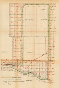
WALL MAP
A large map, typically four or five feet (1.5 m.) on a side, with a top rail and a roller, designed to be displayed on a wall. Many are very decorative. Because wall maps are easily soiled and damaged, many were discarded, and examples of early wall maps are quite scarce and often in bad condition.
WATERMARK
A design in the paper visible by transmitted light. For handmade paper, the watermark is made with bent wires placed on the rack on which the fibers are deposited to make the paper. Designs vary from simple initials to intricate coats of arms. Watermarks are often helpful in identifying the age of the paper. See chain marks.
WOODCUT
An image made by printing from a wooden block on which a mirror image of the design has been carved. Woodcut maps are most often associated with the earliest days of map-making, up to about 1600, but many examples are found well into the 18th-century and later, often as text illustrations.
WOOD ENGRAVING
Similar to a woodcut, but the design is engraved on the end grain, resulting in better detail and a somewhat more uniform appearance. Since the size of exposed end grain is limited by the diameter of the tree trunk, it was usually more economical to cut the design on small squares, which can be glued together for final printing. The joint lines are often visible.
WORMING, WORMHOLES, WORM TRACKS
Damage to paper by hungry insect larvae that eat the paper, leaving small holes or tracks.
WOVE PAPER
Machine-made paper deposited during manufacture on a fine wire screen having about the same mesh size as gauze. The impression left by the screen can often be seen by holding the paper to the light. Wove paper came into use around 1800, and is often watermarked with the maker’s name.
FAQ
- What is Meant by the Term “Antique Map”?
- Condition of Maps & Prints
- Sizes of Antique Maps
- Coloring of Antique Maps
- Map & Print Collecting Terms
- Factors Affecting a Map’s Value
- What Should I Collect?
- What Should I Pay?
- The Care of Maps & Prints
- How to Detect Reproductions
History of Print Making
- Wood Block
- Line Engraving
- Etching
- Mezzotint-Engraving
- Stipple Engraving
- Aquatint Engravings
- Lithographs
- Color Prints