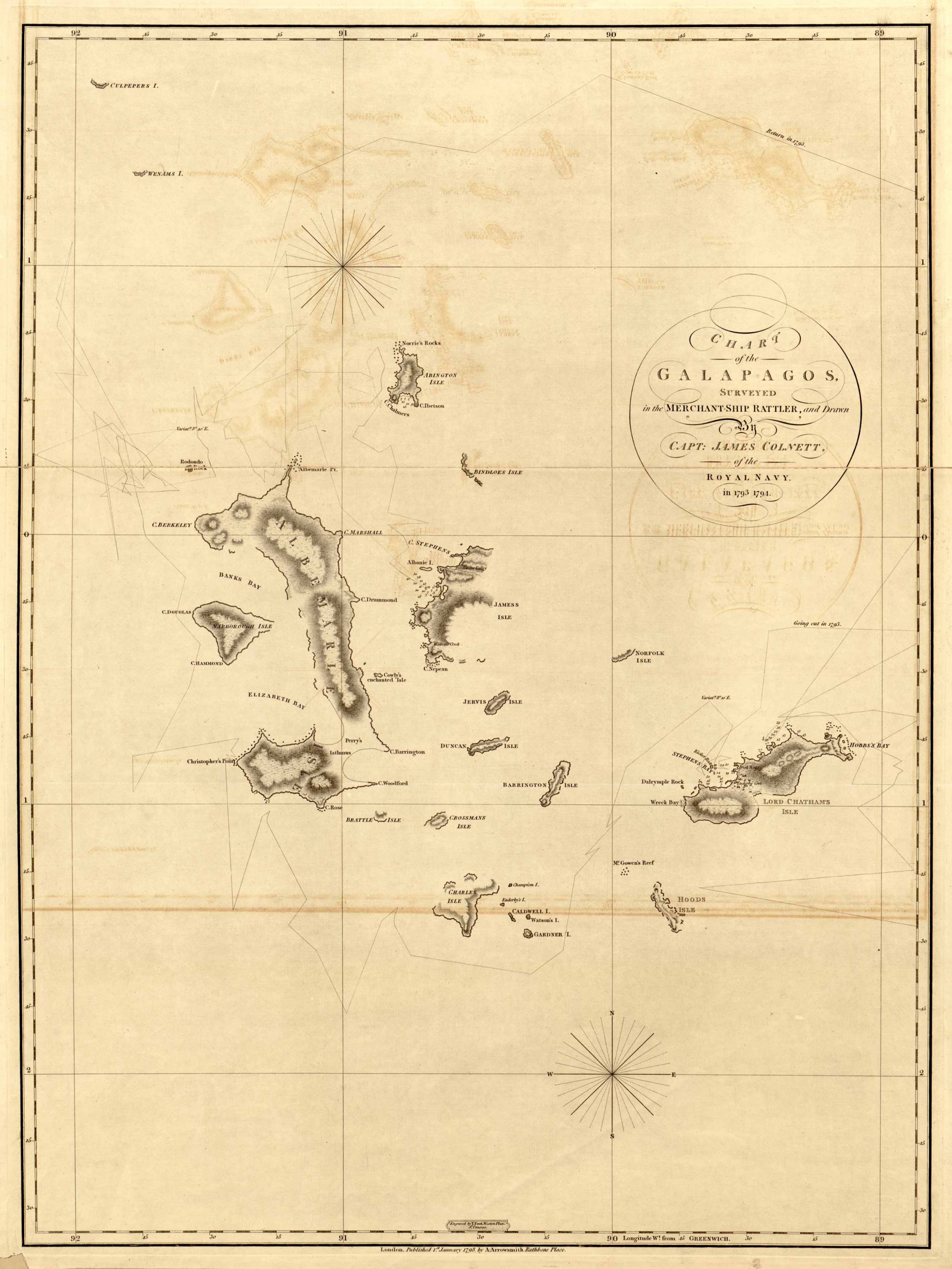
Chart of the Galapagos Surveyed in the Merchant-Ship Rattler and drawn by Captain James Colnett of the Royal Navy in 1793 to 1794. Published at Rathbone Place in London on the 1st of January 1798 by Aaron Arrowsmith, an English cartographer, engraver, and publisher, who was also a founding member of the Arrowsmith family of geographers. This beautiful and old timey map showcases geographic features and islands such as: Norries Rocks, Abington Isle, Banks Bay, Beattle Isle, Crossmans Isle, Duncan Isle, Forfolk Isle, Elizabeth Bay, Charles Isle, Lord Chatham’s Isle, Christopher’s Point, among many others. There is also a beautiful compass on the lower half of the map, along with longitudes and latitudes.
Additional information
| Weight | 0.25 lbs |
|---|---|
| Dimensions | 31.6 × 23.7 × 0.002 in |
Town Name: GALAPAGOS ISLANDS
Map Maker: Aaron Arrowsmith
Original Production Year: 1798
Year: 1798
Map Maker: Aaron Arrowsmith
Original Production Year: 1798
Year: 1798


