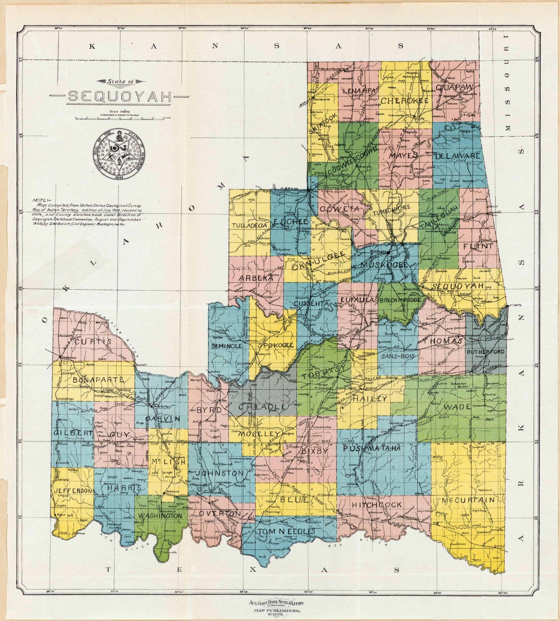
State of Sequoyah, Oklahoma. This map has been compiled from the United States Geological Survey, Map of Indian Territory, edition of July 1902; revised to date, and county divisions made under direction of Sequoyah Statehood Convention. This map shows a number of other surrounding cities and counties around Sequoyah, some being: Thomas, Blue, Wade, Breckinridge, Bixby, Flint, Muskogee, Mayes and many more. On a smaller scale there are also rivers, creeks and other much smaller towns. Texas, Arkansas, Missouri, and Kansas are all featured at its borders.
Additional information
| Weight | 0.25 lbs |
|---|---|
| Dimensions | 17.5 × 15.83 × 0.002 in |
Town Name: SEQUOYAH
Map Maker: Aug. Gast Bank Note and Litho Company
Original Production Year: 1902
Year: 1902
Map Maker: Aug. Gast Bank Note and Litho Company
Original Production Year: 1902
Year: 1902


