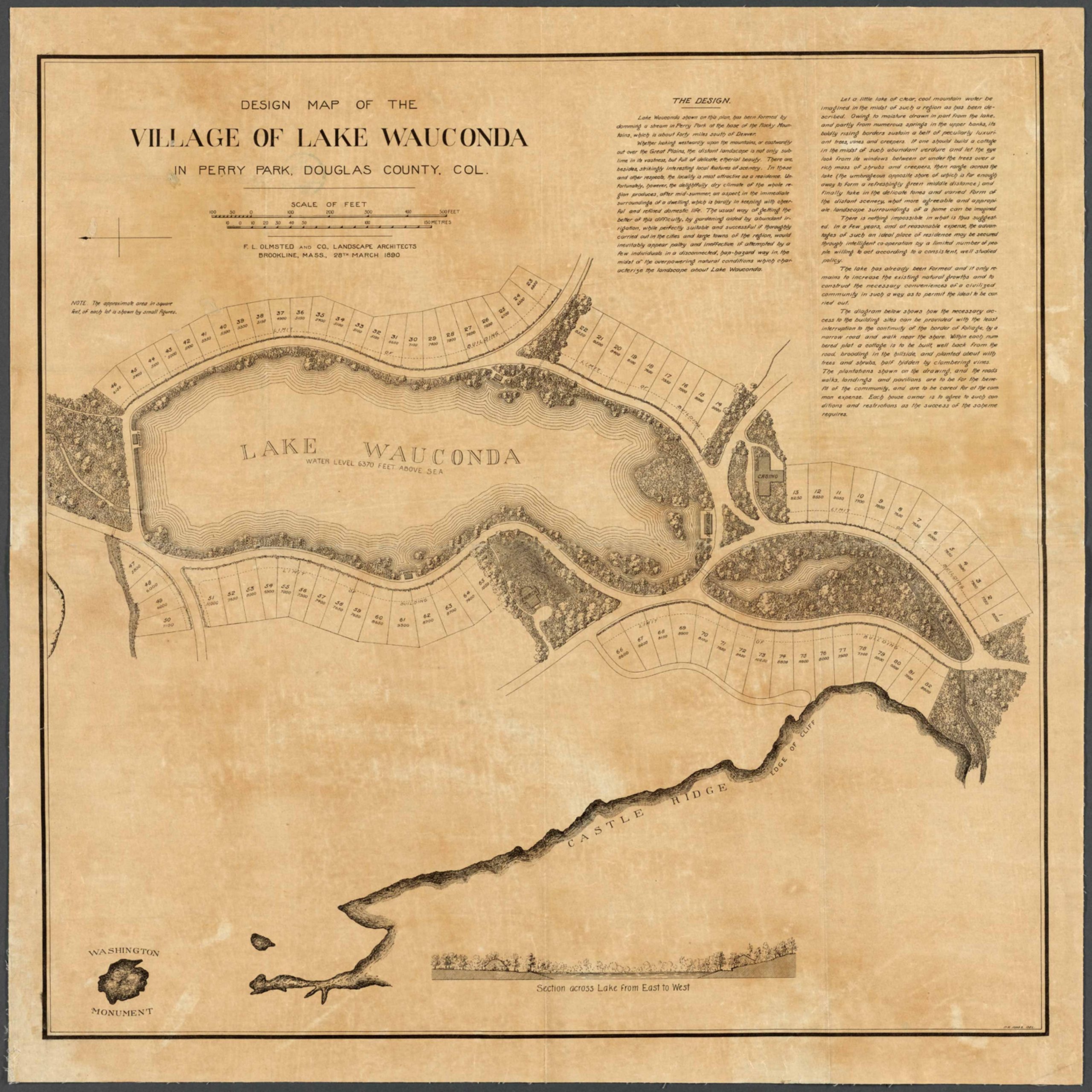
This Design Map of the Village of Lake Wauconda, Perry Park, Douglas County, Colorado 1890 shows streets, lot numbers, and locations of selected buildings. Relief shown by hachures. Oriented with north toward the left. Includes promotional information on design of village in upper right corner and a “section across lake from east to west.”
Additional information
| Weight | 0.25 lbs |
|---|---|
| Dimensions | 20 × 20 × 0.002 in |
Map Maker: F.L. Olmstead and Co. Landscape Architects
Original Production Year: 1890
Year: 1890
Original Production Year: 1890
Year: 1890


