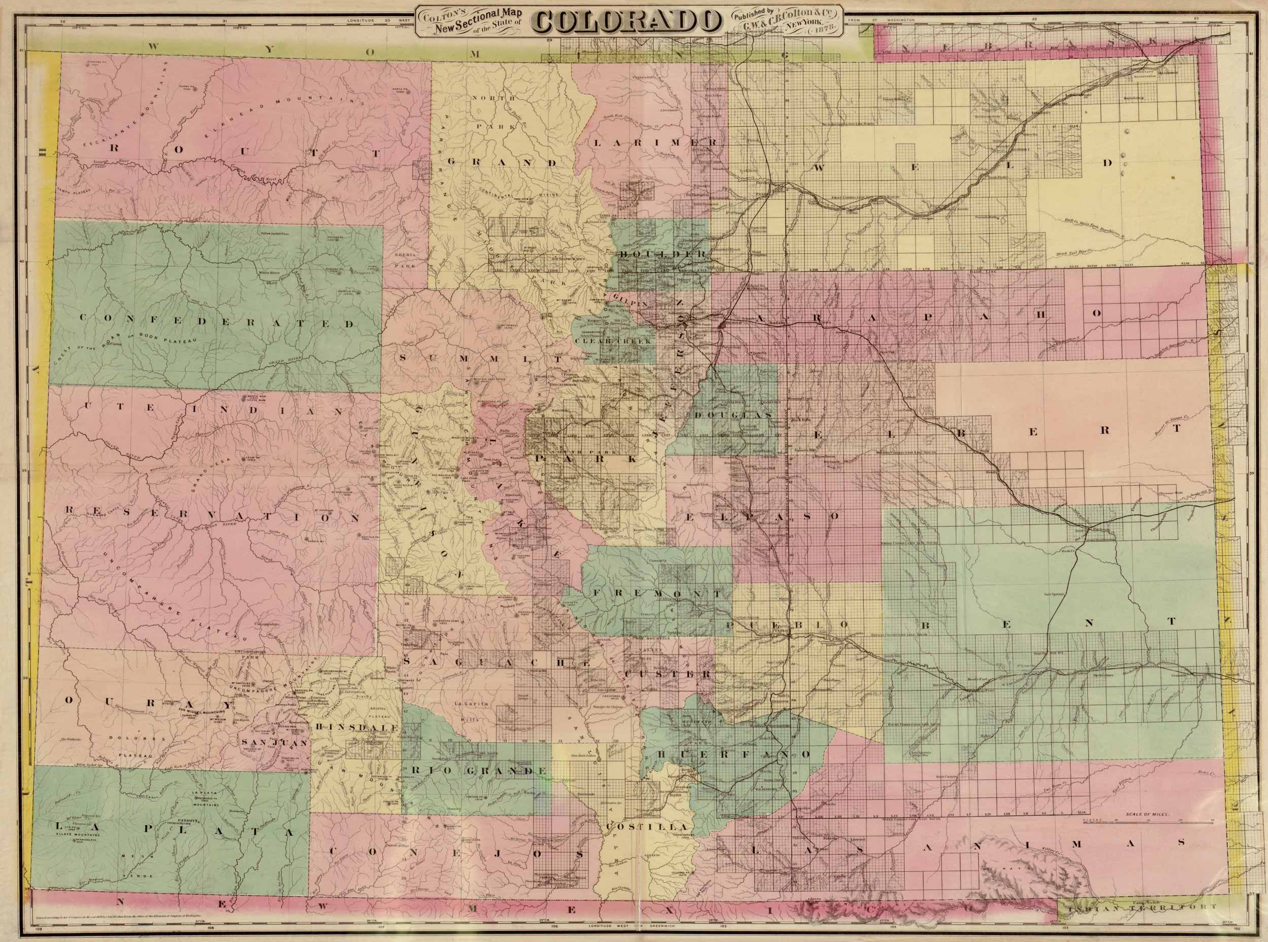
Sectional map of Colorado from 1878. Includes labels of the counties within Colorado that are separated by color. Map made by G.W. & C.B. Colton & Co.
Additional information
| Weight | .25 lbs |
|---|---|
| Dimensions | 15 × 20 × .002 in |
Map Maker: G.W. & C.B. Colton & Co.
Original Production Year: 1878
Original Production Year: 1878


