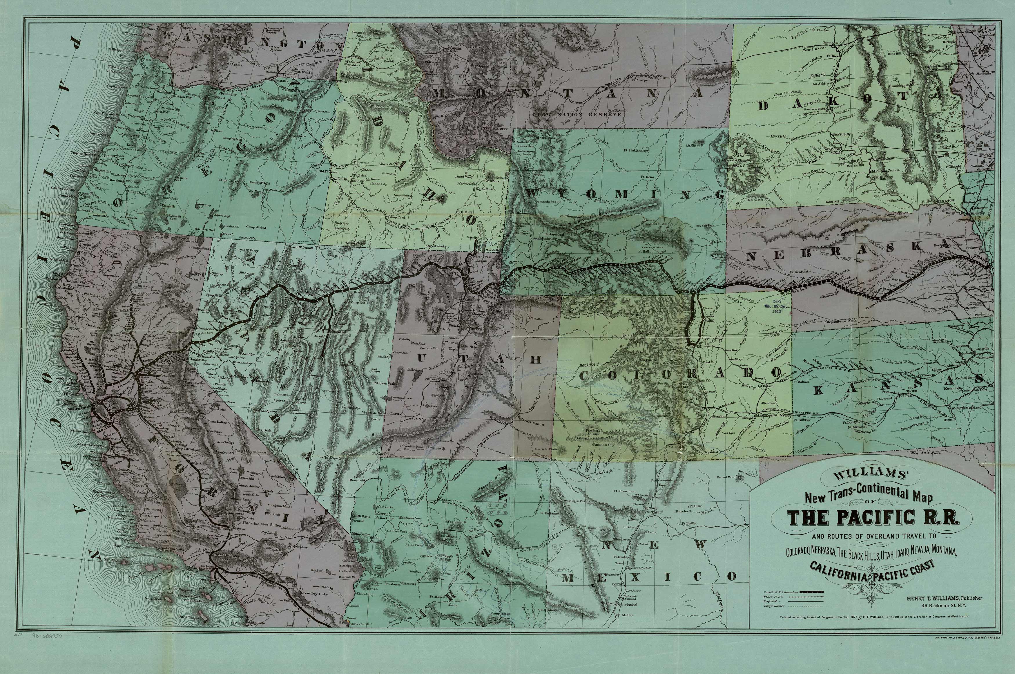
This rare map, published by Henry T. Williams, in 1877 details the Transcontinental Railroad from Omaha to San Francisco. It was first published in the Pacific Tourist and was used to market tours westward. Williams, in his Pacific Tourist, documents the journey by writing, In no part of the world is travel made so easy and comfortable as on the Pacific Railroad. To travelers from the East it is a constant delight, and to ladies and families it is accompanied with absolutely no fatigue or discomfort. One lies at home in the Palace car with as much true enjoyment as in the home drawing room � On the second day out [of Omaha], the traveler is fast ascending the high plains and summits of the Rocky Mountains � He is alive with enjoyment, and yet can scarcely tell why � Ah It is this keen, beautiful, refreshing, oxygenated, invigorating, toning, beautiful enlivening mountain air which is giving him the glow of nature, and quickening him to greater appreciation of this grand impressive country.” The map dramatically highlights mountainous terrain, other intersecting railroad lines, and Indian tribes. The map extends northward to Washington, Montana, and North Dakota and as far south as New Mexico, Arizona, and California. It includes stage coach routes and projected railroads as well. “
Additional information
| Weight | 0.25 lbs |
|---|---|
| Dimensions | 16 × 24 × 0.002 in |
Map Maker: Henry Williams
Original Production Year: 1877
Original Production Year: 1877


