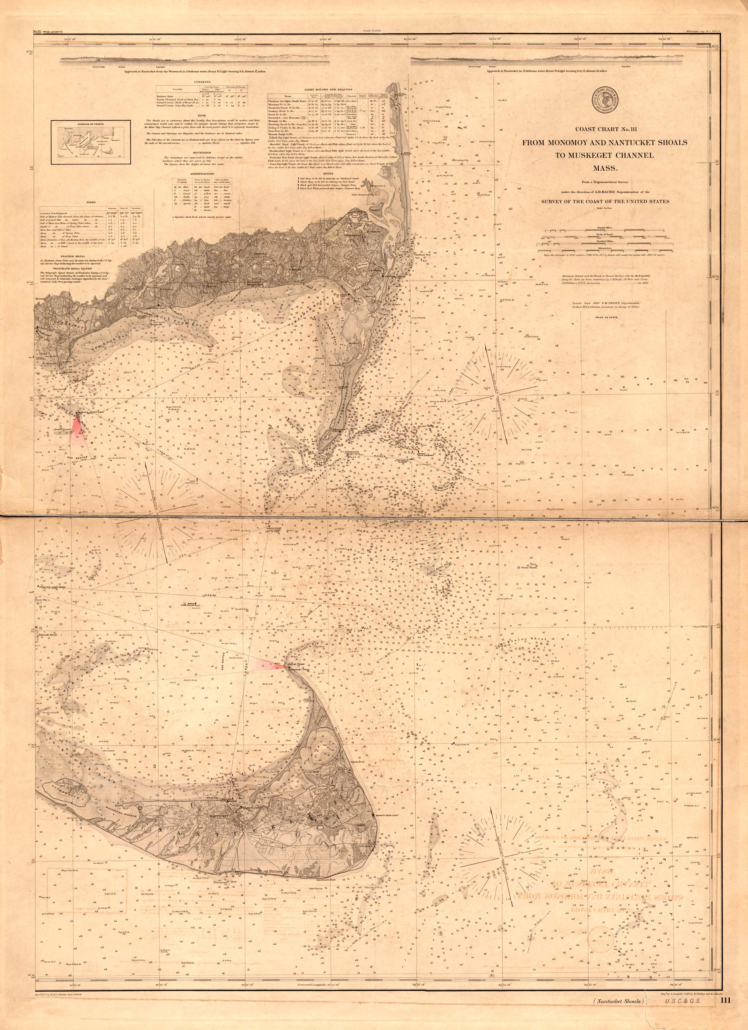
This 1890 U.S. Coast and Geodetic Survey map features Monomoy, the Nantucket Shoals, and Muskeget Channel in Massachusetts. This map contains information about lighthouses, soundings, shoals, bottom types, wrecks, the tides, buoys, and current data. The map also shows neighborhood grids, geographical data, and railroad lines. The map was issued in 1888 and printed in 1890. Previously called the United States Survey of Coast, the U.S. Coast and Geodetic Survey was created on February 10, 1807. It was the United State’s government’s first scientific agency. Jefferson founded it in an effort to map out America’s waters and make navigation safer.
Additional information
| Weight | 0.25 lbs |
|---|---|
| Dimensions | 42 × 30 × 0.002 in |
Map Maker: U.S. Coast and Geodetic Survey
Original Production Year: 1890
Original Production Year: 1890


