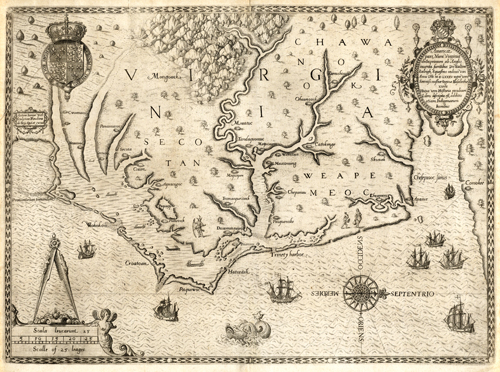
This 1590 map by John White shows Virginia as the English began colonizing it. It was the most accurate map of its time before John Smith’s 1607 map of the Chesapeake areas.Six years prior to this map, in 1584, the English began colonizing North America. Walter Raleigh sent out a party, named the discovered land Roanoke Island, and returned home. A year later, in 1585, mapmaker John White came with a small party to sketch out the area. The Roanoke Colony failed shortly after, and Sir Francis Drake took the surviving colonists home. White returned to the colony in 1587, left for England to gather more provisions, and when he returned in 1590, the colony had failed again. Thomas Hariot, a scientist aboard the ship with White, published a report of Virginia with White’s drawings to help revive interest in the colony. This map captures White’s and other people’s observations and explorations from those times.
Additional information
| Weight | 0.25 lbs |
|---|---|
| Dimensions | 11.5 × 15.5 × 0.002 in |
Map Maker: John White, Theodore De Bry
Original Production Year: 1590
Original Production Year: 1590


