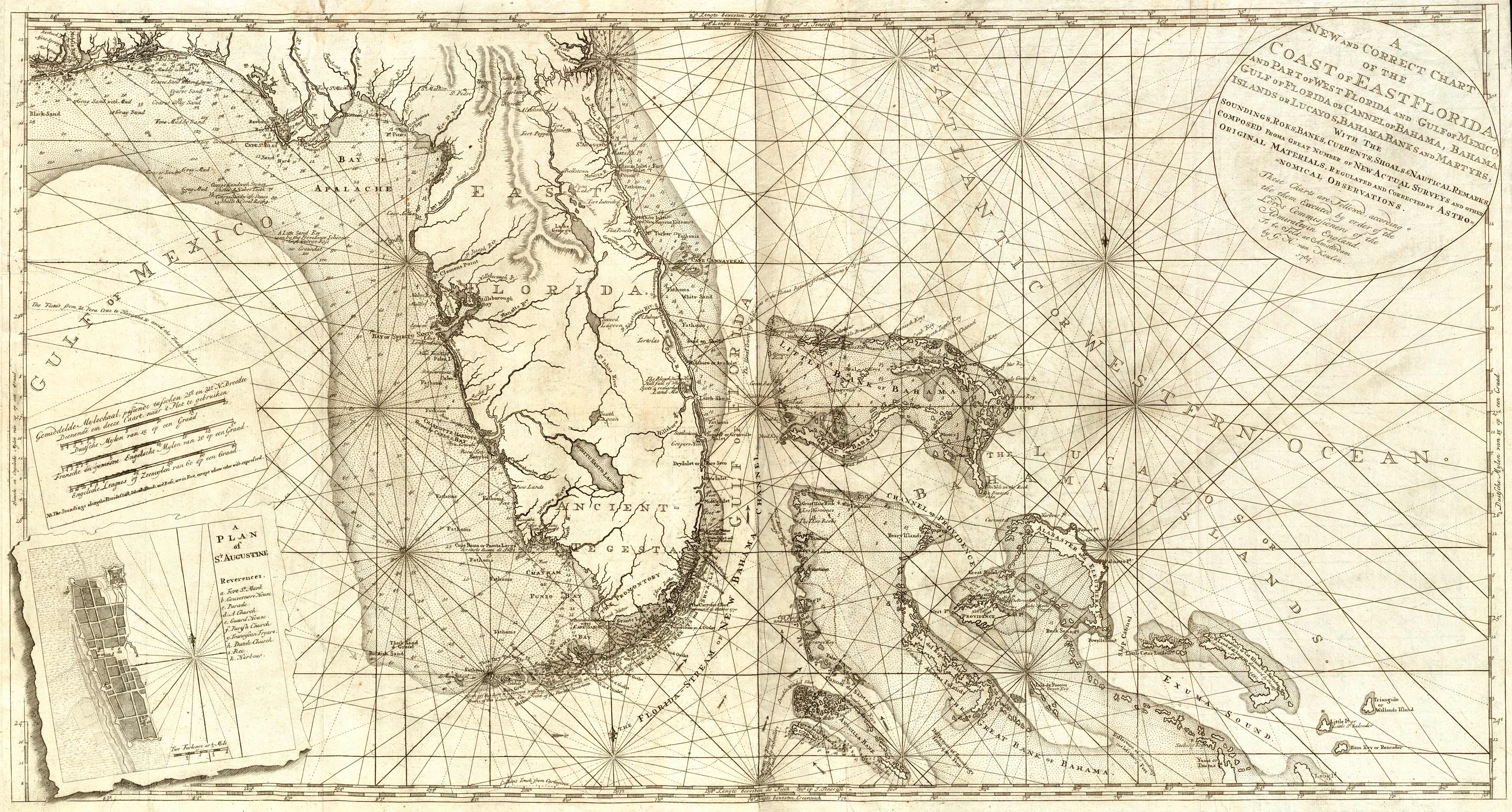
This vast nautical chart by G.H. van Keulen was published in 1784 and is rich with information on the soundings, banks, currents, and shoals of Florida. The inset includes a plan of St. Augustine complete with blueprints of the governor’s house, multiple churches, and a harbor. This map was published in Amsterdam. It shows parts of the Bahamas, the Gulf of Mexico, and Punjo Bay. Various lakes and lagoons are also labeled. The southern part of Florida is referred to as Ancient Tegesta in reference to the Tequesta Native Americans that lived there. Many of the names on this map are still in use today.
Additional information
| Weight | 0.25 lbs |
|---|---|
| Dimensions | 25 × 47 × 0.002 in |
Map Maker: G. H. van Keulen
Original Production Year: 1784
Original Production Year: 1784


