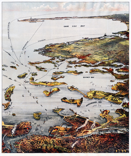
This 1901 map of Boston features Cape Cod, Quincy, and Dorchester Bay.It shows numerous islands including Deer Island, Long Island, Moon Island, Peddock’s Island, Governor’s Island, Lovell’s Island, and Spectacle Island. Steamship routes to Provincetown, Plymouth, and Europe are also depicted.
Additional information
| Weight | 0.25 lbs |
|---|---|
| Dimensions | 21 × 17.6 × 0.002 in |
Map Maker: Murphy, John F.
Original Production Year: 1901
Original Production Year: 1901


