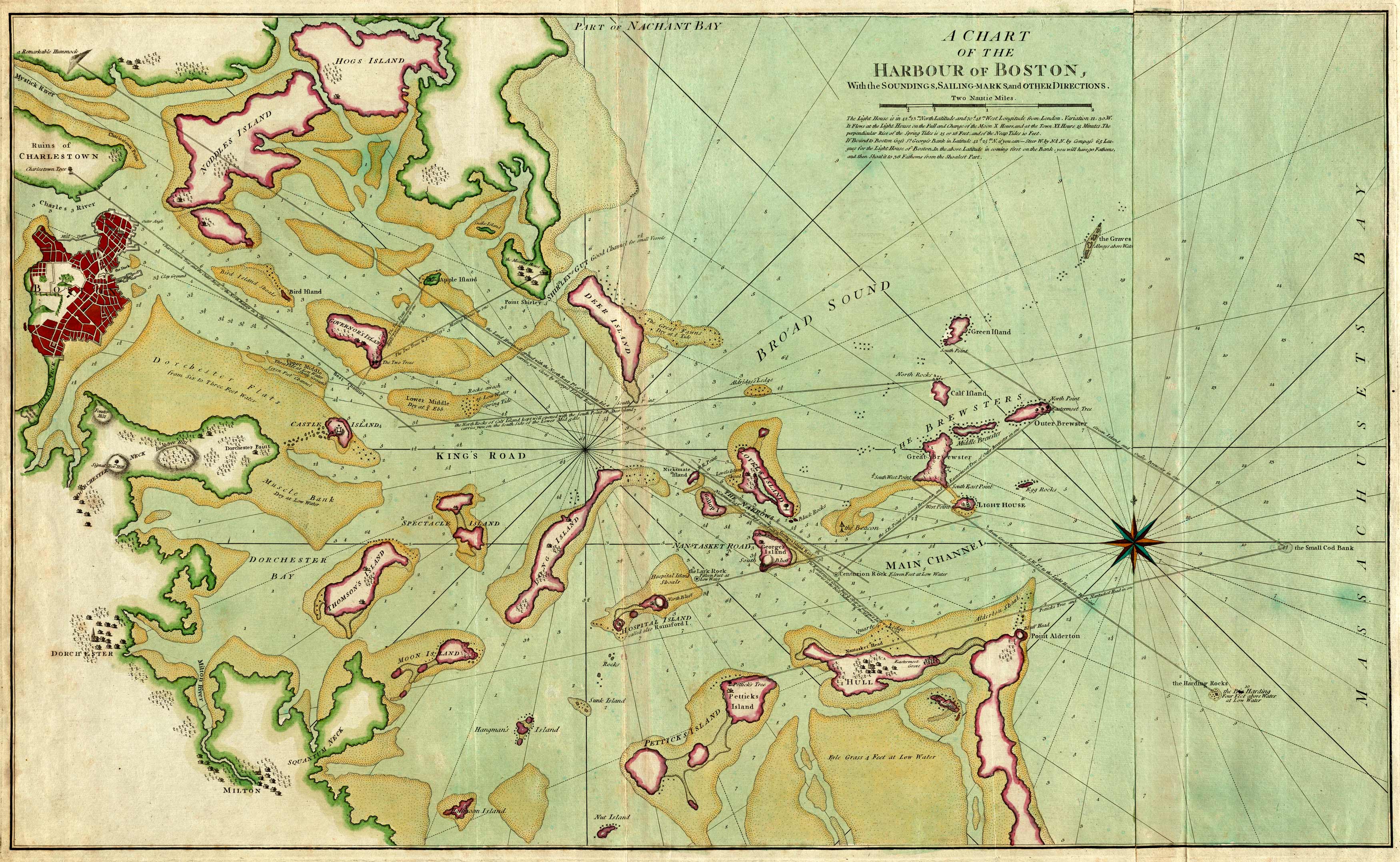
This 1776 nautical chart of Boston Harbor shows Hogs, Noddles, Governor’s, Castle, Thompson’s, and Moon Island. The towns of Dorchester and Milton are also shown. The Mystic and Charles Rivers are identified. This map provides soundings, sailing marks, and other directions.
Additional information
| Weight | 0.25 lbs |
|---|---|
| Dimensions | 36.5 × 24.5 × 0.002 in |
Map Maker: Robert Sayer, John Bennett
Original Production Year: 1776
Original Production Year: 1776


