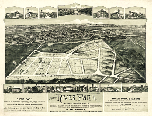
This map advertises River Park to prospective business owners. The map describes the location as desirable building lots in the beautiful suburb of Boston.” It goes on to say River Park “is situated on the banks of the Charles River, 10 miles from Boston” with “electric cars, electric lights, water supply, wide streets, and avenues nicely graded.” In the insets, the map shows a pumping station, paper mill, rubber factory, silk mill, baptist church, Echo Bridge, and the residences of Otis Pettee and A.T. Sullivan. “
Additional information
| Weight | 0.25 lbs |
|---|---|
| Dimensions | 18 × 24 × 0.002 in |
Map Maker: Anonymous
Original Production Year: 1890
Original Production Year: 1890


