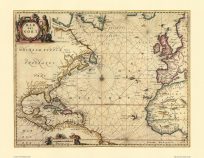
This map depicts North America following the American Revolutionary War. Extensively detailed, it shows the Great Lakes, the Appalachian Mountains, identifies each colony and key cities, documents Native American populations, and shows various rivers and forts spread throughout the United States. The map expands as north as the Lake Superior in Canada, as far east as Newfoundland, as far south as the Gulf of Mexico, and as far west as the then-French territory of Louisiana. In the inset in the bottom right corner, the map shows Chesapeake Bay. In the inset in the top left corner, the map shows Cuba, Jamaica, and the Bahamas. Around this time, the Napoleonic Wars dominated French politics, and the United States had further interest in western territory. In 1803, some years after this map, the United States signed the Louisiana Purchase from the French, who needed the funding for war, for $15 million.
Additional information
| Weight | 0.25 lbs |
|---|---|
| Dimensions | 21 × 30 × 0.002 in |
Map Maker: Phelipeau, Ren�
Original Production Year: 1783
Original Production Year: 1783


