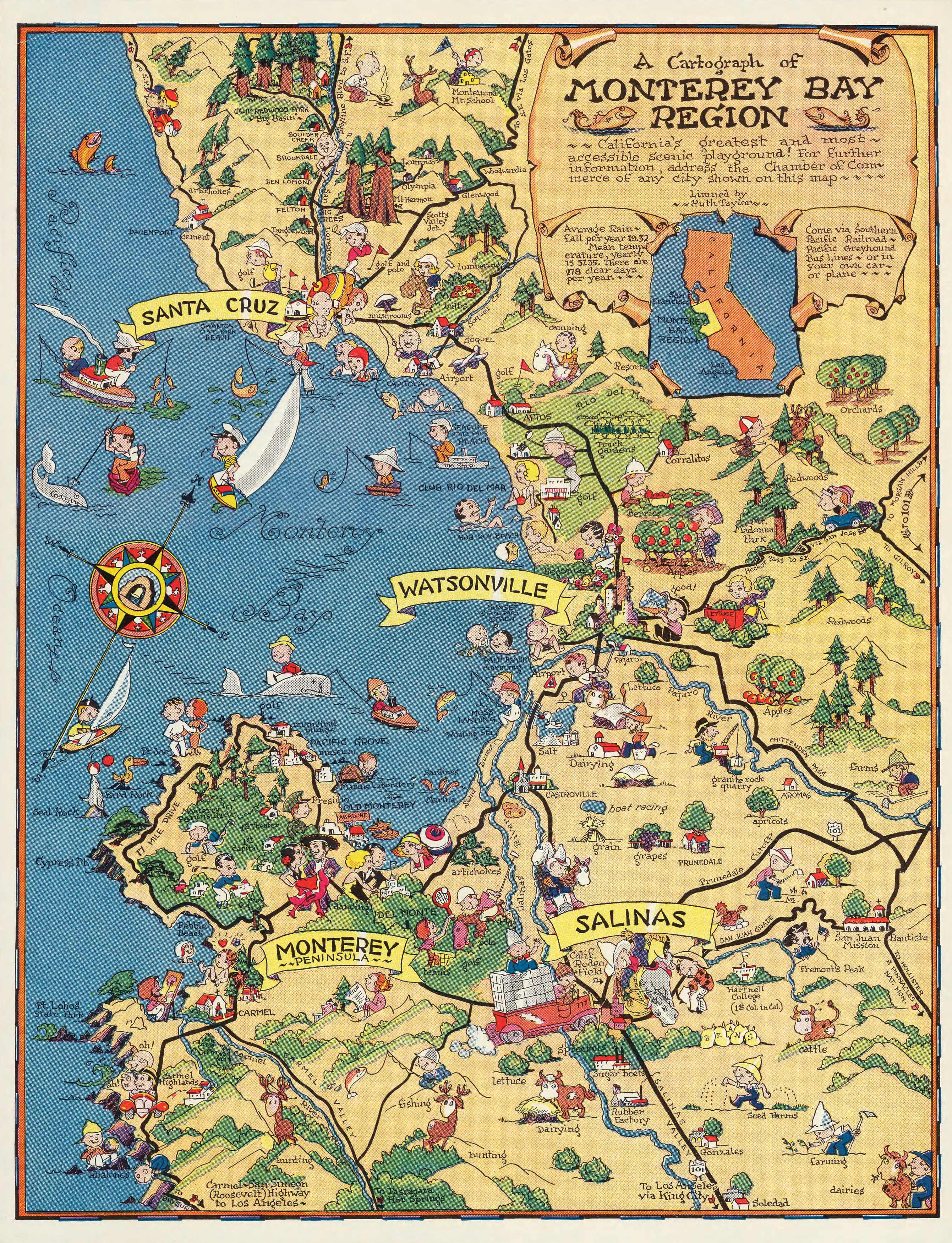
This pictorial map of the Monterey Bay region by Ruth Taylor White, covers the area along the California coast from above Santa Cruz to below Salinas. It includes brightly colored illustrations with White’s charming figures indicating the activities of various areas. First published in 1932 this map is an illustrative piece for any map enthusiast.
Additional information
| Weight | 0.25 lbs |
|---|---|
| Dimensions | 22 × 16.8 × 0.002 in |
Map Maker: Ruth Taylor White
Original Production Year: 1932
Original Production Year: 1932


