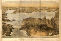
This unusual and interesting view shows the central portion of Minneapolis and the Mississippi River. On the left are the great flour mills and in the center are the railroad and carriage bridges connecting the two parts of the city.
Additional information
| Weight | 0.25 lbs |
|---|---|
| Dimensions | 16.3 × 24 × 0.002 in |
Map Maker: Unknown
Original Production Year: 1886
Original Production Year: 1886


