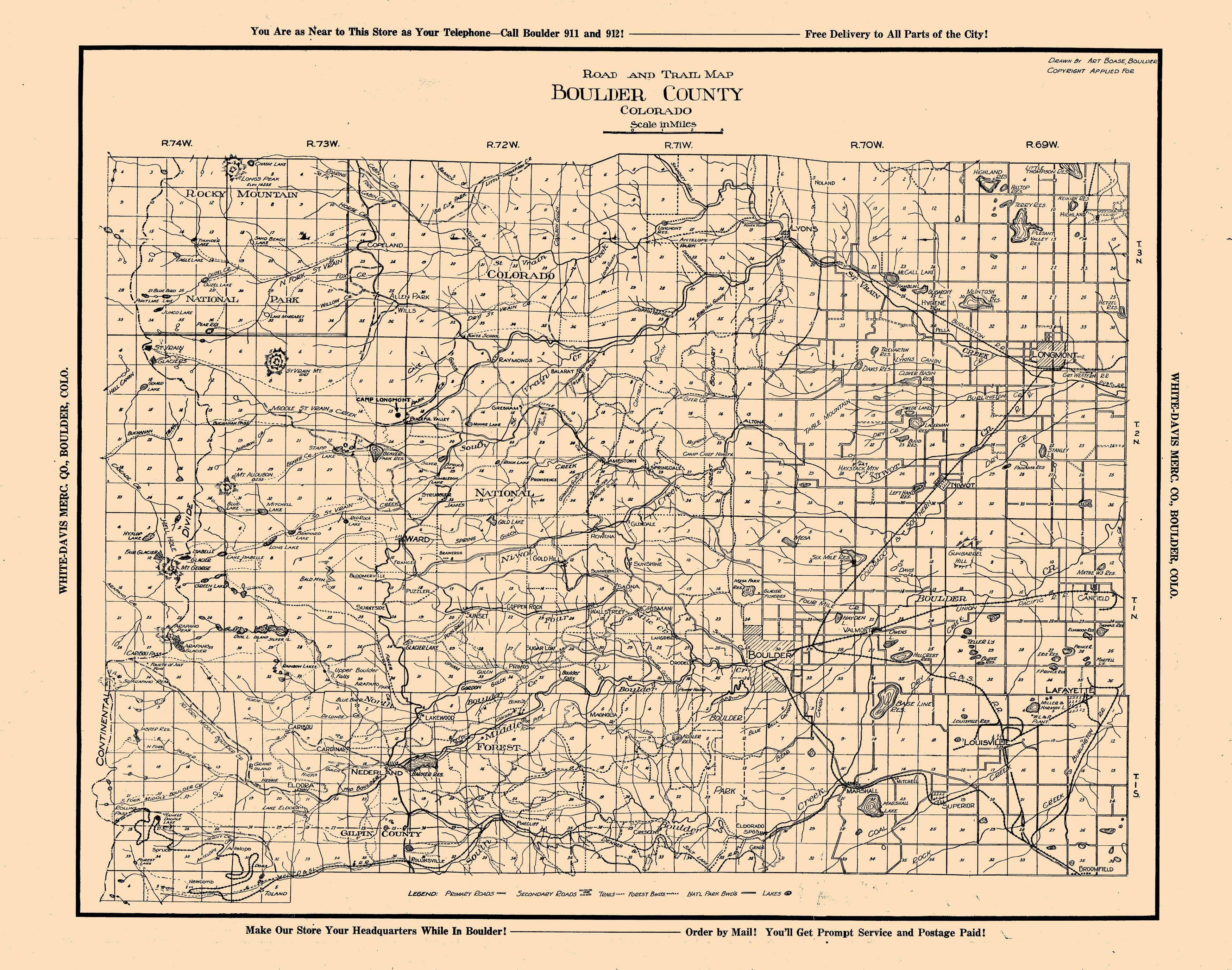
This hand-drawn map road and trail map of Boulder County shows towns, roads, trails, forest and National Park boundaries, as well as lakes, creeks, and other interesting geographical features.
Additional information
| Weight | 0.25 lbs |
|---|---|
| Dimensions | 18.9 × 24 × 0.002 in |
Map Maker: Art Boase, for the White-Davis Mecantile Co.
Original Production Year: 1920
Original Production Year: 1920


