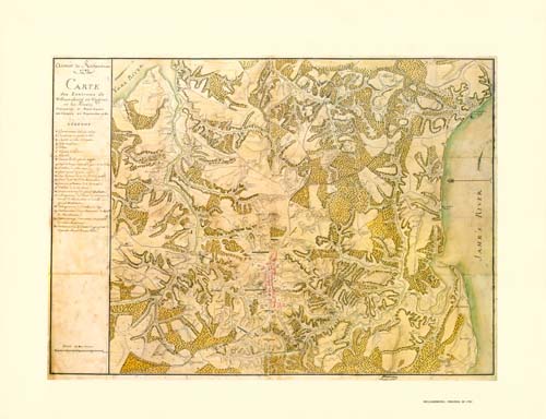
This map of Williamsburg, Virginia was created in 1782 by a French military cartographer. In September 1781 French forces under Rochambeau were in Williamsburg preparing to join Washington’s troops for the siege of Yorktown. This fully colored facsimile is one-half the size of the original.
Additional information
| Weight | 0.25 lbs |
|---|---|
| Dimensions | 17.3 × 24 × 0.002 in |
Map Maker: Unknown
Original Production Year: 1782
Original Production Year: 1782


