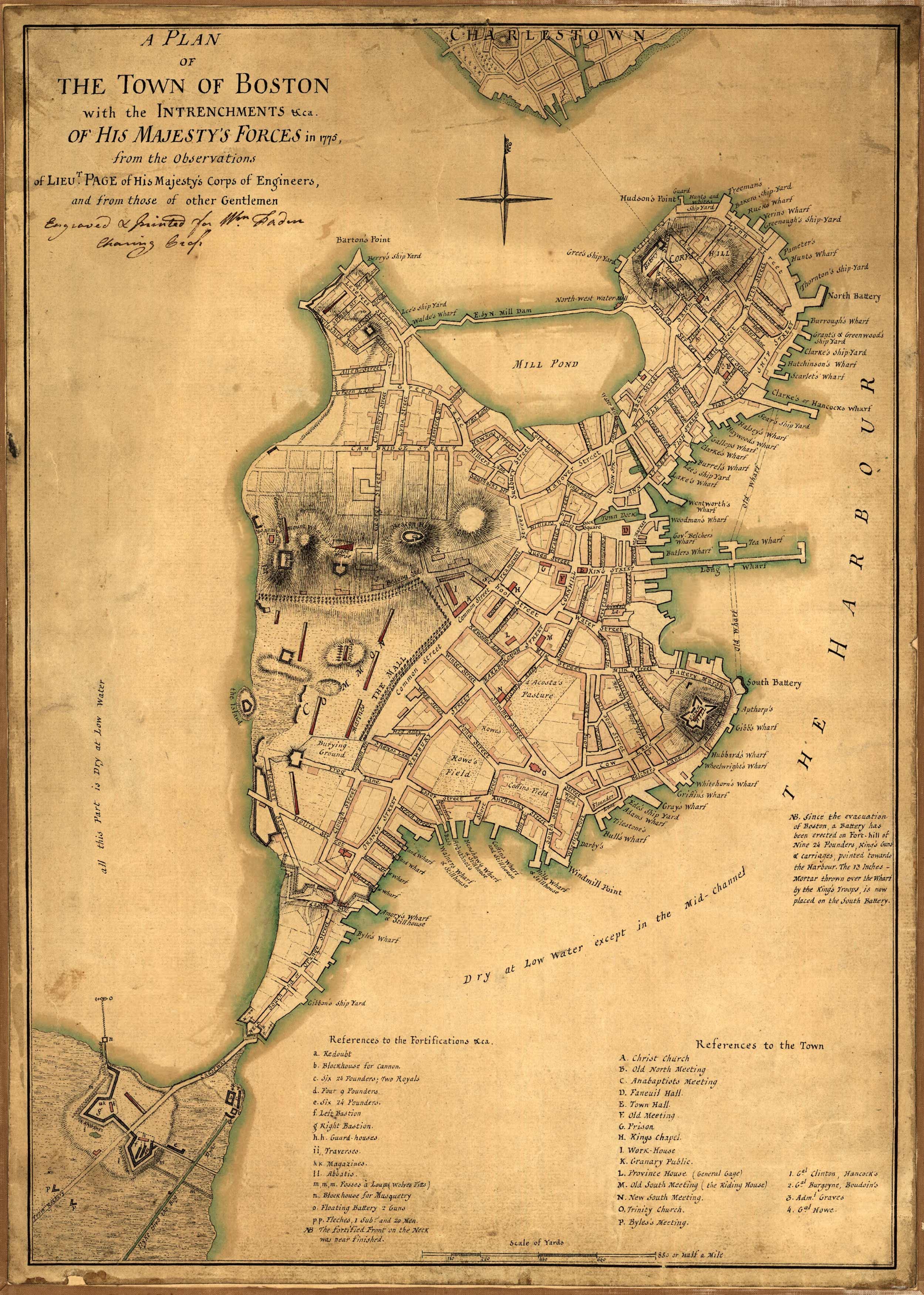
This detailed manuscript map was done in 1777 and shows a plan of the town of Boston with the entrenchments of His Majesty’s forces in 1775, from the observations of Lieutenant Page of His Majesty’s Corps of Engineers, and from those of other gentlemen. The map says that it was engraved and printed for William Faden, Charing Cross. William Faden was an extremely well known English cartographer, mapmaker and publisher in the late 18th century. This map is special because it was a manuscript map, done with pen and ink and watercolor. Manuscript maps are unique because they were hand drawn and almost always were one of a kind. Sir Thomas Hyde Page was a decorated British military engineer and cartographer for the English crown. Page went with the corps of engineers to North America and distinguished himself in service to General Pigott at the Battle of Bunker Hill in June of 1775, where he was severely wounded. He drew several maps of Boston Harbor and the Bunker Hill area during that time.
Additional information
| Weight | 0.25 lbs |
|---|---|
| Dimensions | 36 × 25.7 × 0.002 in |
Map Maker: Sir Thomas Hyde Page
Original Production Year: 1777
Original Production Year: 1777


