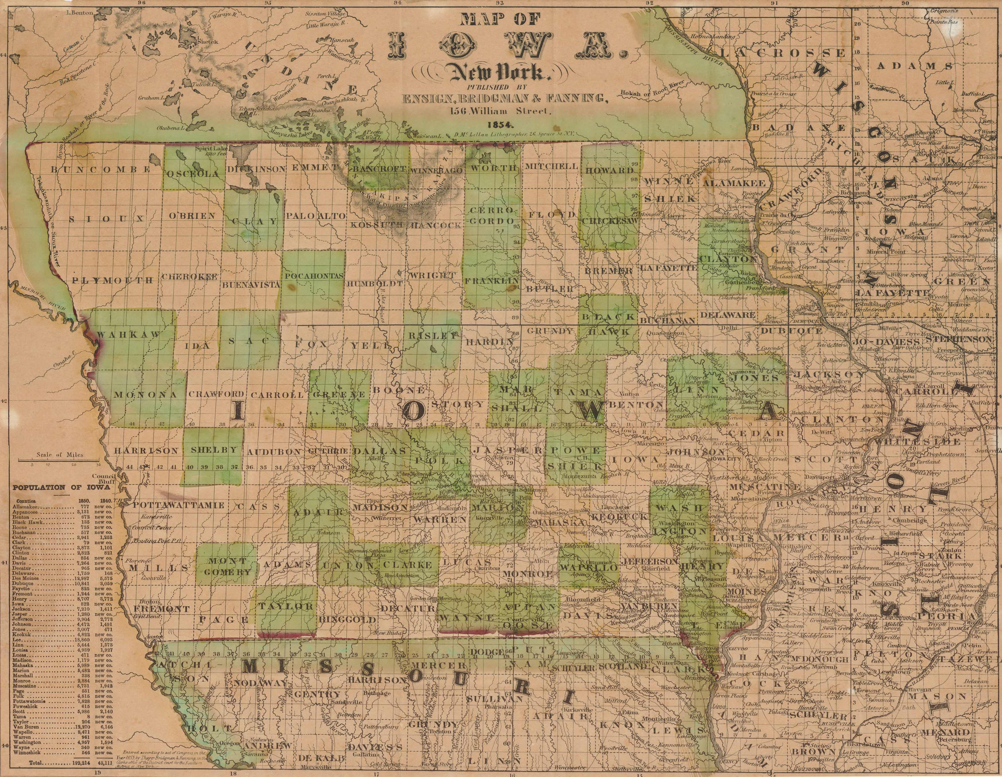
This map of Iowa by Ensign, Bridgman and Fanning, published in 1854, is appealing in that it shows all the counties in the state. This map is covered in a plethora of labeled rivers and lakes, included an inset of the population growth of all the different counties, ranging from 1840-1850. It also shows the total population for the state. Wisconsin, Missouri and Illinois are all bordering the state.
Additional information
| Weight | 0.25 lbs |
|---|---|
| Dimensions | 18.5 × 24 × 0.002 in |
Map Maker: Ensign, Bridgman & Fanning
Original Production Year: 1854
Original Production Year: 1854


