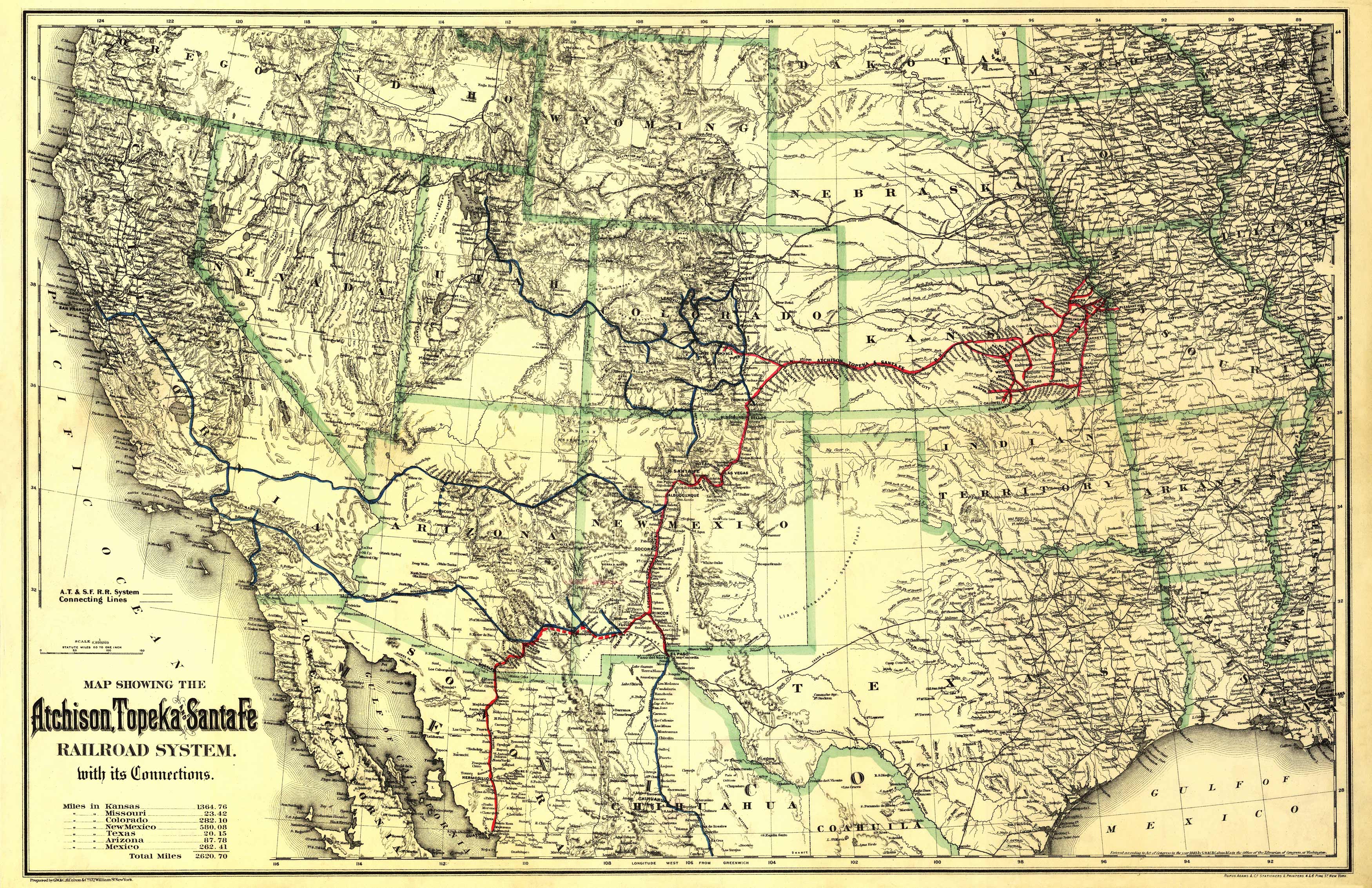
This beautiful map of the southwestern states shows Mississippi River to the Pacific Ocean. It also indicates in table form miles of lines in Kansas, Missouri, Colorado, New Mexico, Texas, Arizona, and Mexico. It shows relief by hachures, drainage, state boundaries, and cities and towns.
Additional information
| Weight | 0.25 lbs |
|---|---|
| Dimensions | 15.5 × 24 × 0.002 in |
Map Maker: G.W. & C.B. Colton & Co.
Original Production Year: 1883
Original Production Year: 1883


