 |
||
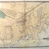
The Plan of the Borough of New Rochelle, Westchester County, New York
Out of stock
This map is from the Atlas of New York and Vicinity by F.W. Beers, A.D. Ellis and G.G. Soules, printed in 1867. Any resident of the featured area will appreciate the window into another time offered by these maps- making them fantastic gifts. All maps show great detail and are hand colored in bright pastels. This map illustates the plan of the borough of New Rochelle. Details include street names, land owners, important businesses and rail lines.
Size: 25.25 x 18.25 inches
Condition: Good
Map Maker: F.W. Beers, G.G. Soule, A.D. Ellis
Coloring: Hand Colored
Year: 1867
Condition: Good
Map Maker: F.W. Beers, G.G. Soule, A.D. Ellis
Coloring: Hand Colored
Year: 1867
Out of stock