 |
||
LAlgerie (Algeria)’
Out of stock
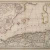
This hand colored map is from the “Atlas de Geographie”, made by Felix Delamarche in Paris, 1856. Algeria is illustrated on this well maintained French map. Insets show territories and the plans of important cities in Algeria. Pastel colors were used distinguish regions. Other details include identification (in French) of regions, important cities, rivers, lakes, and mountain ranges.
Size: 11.5 x 17 inches
Condition: Very Good- age toning, very light off-setting
Map Maker: Delamarche
Coloring: Original Hand Color
Year: 1856
Condition: Very Good- age toning, very light off-setting
Map Maker: Delamarche
Coloring: Original Hand Color
Year: 1856
Out of stock