 |
||
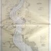
New Jersey and Delaware-Delaware River, Smynra River to Willmington
Out of stock
This coastal survey was made in Washington D.C. in November, 1944 by the U.S. Coast and Geodetic Survey department.The Delaware River between Smyra River to Wilmington and the land surrounding (the coasts of New Jersey and Delaware) are illustrated on this map. Details include depth readings,major roads and important cities along the coast,identification of prohibited and restricted areas where appropriate, cable areas, the locations of radio beacons, and a table to show the variation of the tide. Other Details include: Date of Issue and most recent corrections hand stamped on map Notes on the map read – WARNING: Aids to navigation may be altered, interrupted or removed without notice. In general, temporary changes due to war conditions are not incorporated in the chart. Caution Improved Channels- The side limits of the improvement are shown by broken lines. The controlling depth through the channel, on the date given, is placed in or alongside the channel, or in a seperate note, but no depth greater than the project depth is given. Because of possible shoaling, particularly at the edges, it must not be inferred that the depth stated exsisted throughout the entire width of the improvement on the date of the examination unless so stated, or that it has not since decreased in places across the entire width. Caution The depths in the channel at the entrance of the Christina River are constantly changing. Strangers should not attempt to enter without obtaining local information. Local Magnetic Attraction In the vicinity of Willmington, Delaware, the direction of the compass needle has been observed on the shore to differ as much as 5 degrees from the chart value
Condition: Excellent
Map Maker: U.S. Coast and Geodetic Survey
Coloring: Machine Color
Year: 1944
Out of stock