 |
||
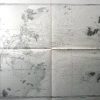
Approaches to Min Kiang
Out of stock
This coastal survey was made in September of 1944 by H.O. Miscel-from British and Chinese charts. Approaches to Min Kiang are illustrated on this map. Details include the names of important cities, depth readings, occasional descriptions of the area, and illustrations where the coast is heavily wooded. A chart converts fathoms to meters, another translates Chinese terms to English. Most identification is in Chineses characters.
Size: 39.25 x 26.75 inches
Condition: Excellent
Map Maker: H.O. Miscel
Coloring: Black and White (Some Machine Color)
Year: 1944
Condition: Excellent
Map Maker: H.O. Miscel
Coloring: Black and White (Some Machine Color)
Year: 1944
Out of stock