 |
||
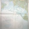
Louisiana- Point Au Fer to Marsh Island
Out of stock
This coastal survey was made in Washington D.C. and is dated November 25,1944 as the date of final correction by the U.S. Coast and Geodetic Survey. Point Au Fer to Marsh Island on the Louisiana coast is illustrated on this map. Details include depth readings, lights, buoys, radio beacons ( stamped on map), and the names of important cities and waterways along the coast. The most recent corrections are hand stamped on the map.
Size: 31 x 43.5 inches
Condition: Excellent
Map Maker: U.S. Coast and Geodetic Survey
Coloring: Machine Color
Year: 1944
Condition: Excellent
Map Maker: U.S. Coast and Geodetic Survey
Coloring: Machine Color
Year: 1944
Out of stock