 |
||
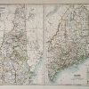
New Hampshire -Maine
Out of stock
This beautiful map was made by Adam and Charles Black in 1889 for the library eddition of “The Scribner-Black Atlas of the World”. New Hampshire and Maine are illustrated on seperate maps on this page.An inset shows the states of New England at a smaller scale. The names of counties, important cities, lakes and rivers are identified. These maps are in very good condition with only slight age toning and bright crisp color.
Size: 15.25 x 10.75 inches
Condition: Very Good-age toning
Map Maker: Adam & Charles Black
Coloring: Machine Color
Year: 1889
Condition: Very Good-age toning
Map Maker: Adam & Charles Black
Coloring: Machine Color
Year: 1889
Out of stock