 |
||
New Zealand
Out of stock
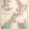
This hand colored map was made by Adam and Charles Black in 1851 for “Black’s General Atlas”. New Zealand, which is rarely shown individualy on a map, is illustrated on this page. Two insets show the settled portion of Western Australia and Tasmania, which was then known as Van Diemens Land”. Regions are distinguished by color. Other details include the names of regions and many cities, lakes, rivers, and mountains. The impression of the press used to engrave the map is still evident.
Size: 11 x 15 inches
Condition: Very Good-age toning
Map Maker: Adam and Charles Black
Coloring: Original Hand Color
Year: 1851
Condition: Very Good-age toning
Map Maker: Adam and Charles Black
Coloring: Original Hand Color
Year: 1851
Out of stock