 |
||
Indiana
In stock
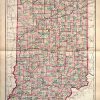
This hand colored map was made by O.W.Gray and son in 1881 for “The National Atlas”. Indiana is illustrated on this map. Counties are differentiated by color. Other details include the names of counties and important cities, and illustrations of railroads, lakes, and rivers. This map has retained its original bright coloring very well for its age.
Size: 16 x 25 inches
Condition: Good- light foxing at edge of page, age toning
Map Maker: O.W. Gray and Son
Coloring: Original Hand Color
Year: 1881
Condition: Good- light foxing at edge of page, age toning
Map Maker: O.W. Gray and Son
Coloring: Original Hand Color
Year: 1881
In stock