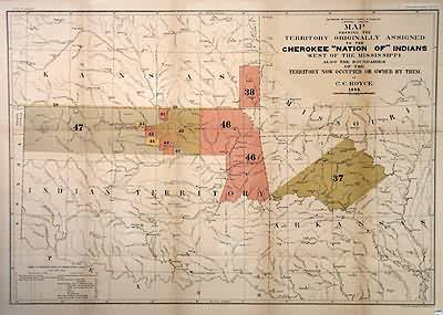
Map Showing the Territory Originally Assigned to the Cherokee Indians
Out of stock
This map, made in 1884 by C.C. Royce and published by the Smithsonian Institute shows the Cherokee territory. Both the land assigned to the tribes originally and the boundries occupied by them at the time the map was made are shown. A chart below the map shows the treaties, dates signed, and gives a key to explain the color coding on the map that distinguishes between tribes.
Size: 30 x 20.75 inches
Condition: Very Good- light age toning
Map Maker: C.C. Royce
Coloring: Hand Color
Year: 1884
Condition: Very Good- light age toning
Map Maker: C.C. Royce
Coloring: Hand Color
Year: 1884
Out of stock


