 |
||
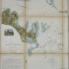
Preliminary Chart of Muskeget Channel, Massachusetts
Out of stock
This is an 1854 United States Coastal Survey of Muskeget Channel, Massachusetts. Sailing directions,light house locations, information on tides and tidal currents and topographical features are illustrated and noted. Views of Holmes Hole, the North entrance to Muskeget Channel, and of Cape Poge are included. Hand colored and in beautiful condition.
Size: 20.5 x 28 inches
Condition: Very Good- small tears along edges
Map Maker: U.S Coast Survey Dept.
Coloring: Hand Coloring
Year: 1854
Condition: Very Good- small tears along edges
Map Maker: U.S Coast Survey Dept.
Coloring: Hand Coloring
Year: 1854
Out of stock