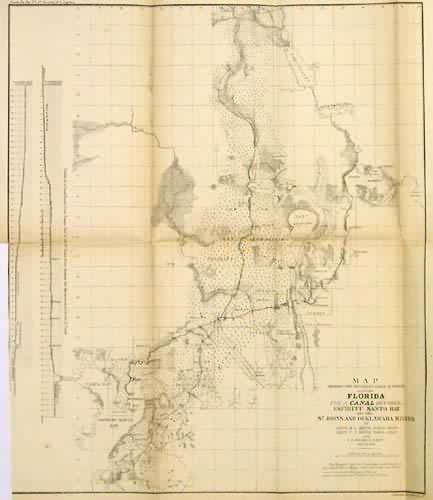
Map Showing the Different Lines of a Survey Across Florida for a Canal Between Espiritu Santo Bay and the St. Johns and Ocklawaha Rivers
In stock
With the increase in population and the growing rise of Florida’s agricultural industry, mostly through the introduction of slave labor, a canal was proposed to aid transportation of goods to and from central Florida. This map marks the proposed route of the canal along with survey lines and townships. Profiles showing the proposed levels of the canal route from Tampa Bay to the St. John’s River are featured along the left margin of the map. Although surveyed and discussed throughout the 1840’s and 1850’s, various delays prevented the canal from being constructed. Eventually, the technology behind the railroad allowed for a route along the same path, but at a much cheaper cost to construct and operate. The cartographer notes various forts, swamps, creeks, rivers, lakes, prairies, and various other topographical features in the area.
Condition: Good, small split along center seam
Map Maker: General Land Office
Coloring: Black and White
Year: 1854
In stock


