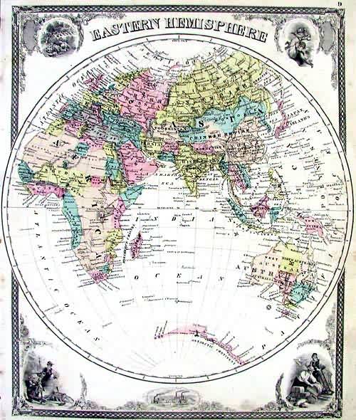
Eastern Hemisphere
In stock
This detailed image was originally published in the “Illustrated Historical Atlas of the State of Indiana.” This is a majestic decorative map of the world, made the year of the US centennial. Perhaps it was a bit of patriotic sentiment that led Baskin & Forster to create these attractive hemispheric maps and their surrounding vignettes, which would eclipse any of the British work of the time in drama and scale. The maps themselves are very detailed and specific, including hundreds of smaller islands in the pacific and the exotic, remote cities of foreign lands (Timbuctoo), as well as detailed coverage for all of the continents. Around the maps we see images taken from the past, and scenes of present US industry. Images of cherubs and Greek goddesses mingle across from Blacksmiths working around their anvils and shippers filling their warehouse. With an intricate decorative border encompassing the image, this is an outstanding American view of the 19th century world.
Condition: Very Good
Map Maker: Baskin & Forster
Coloring: Original Hand Coloring
Year: 1876
In stock


