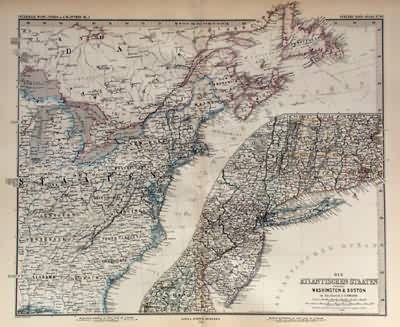
West Indien in 4 Blattern (Bl.2)(NORTH-EAST UNITED STATES)
In stock
This German map of the north-east United States was made in 1881 by Adolf Stieler for Stieler’s Hand Atlas. Regions are distinguished by beautiful hand painted outline color. This very detailed map shows many place names, topographical features, and major roads. The inset shows the coast from Boston to Washington at a greater scale.
Size: 16 x 13.75 inches
Condition: Very Good
Map Maker: Adolf Stieler
Coloring: Original Hand Color
Year: 1881
Condition: Very Good
Map Maker: Adolf Stieler
Coloring: Original Hand Color
Year: 1881
In stock


