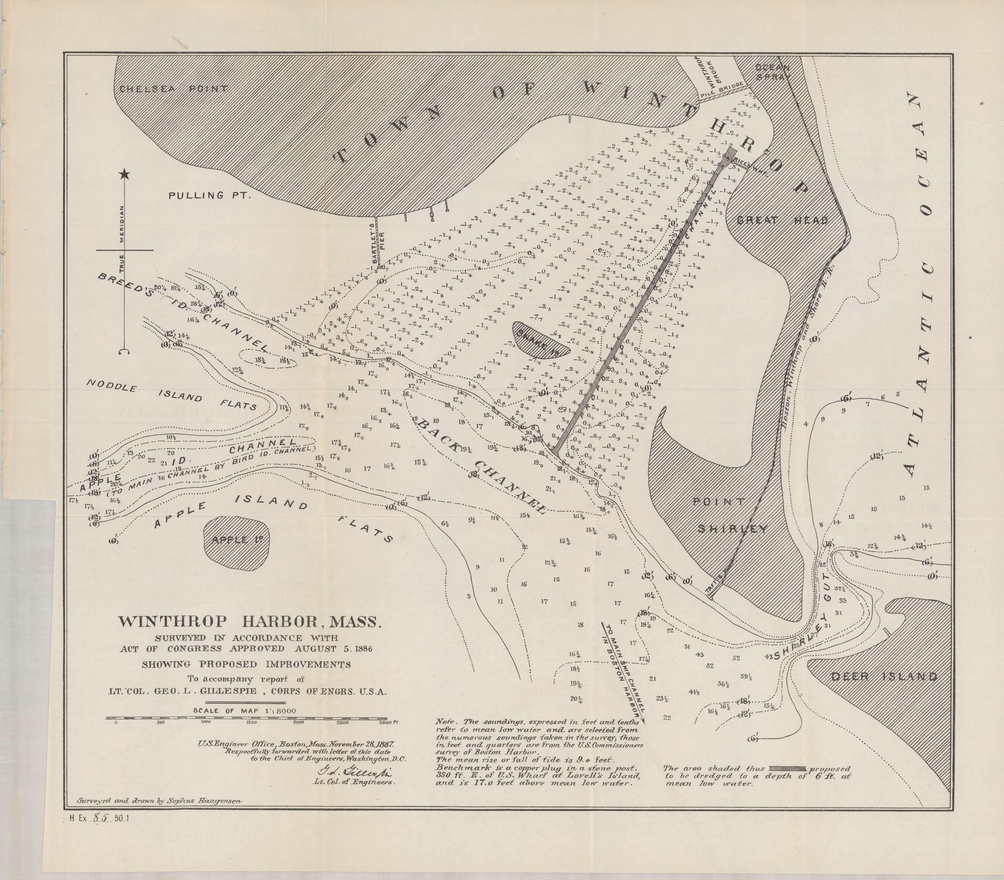
Winthrop Harbor, Mass.
In stock
A special chart of Winthrop Harbor, MA, what is also known now as Crystal Cove, was issued by the Corps of Engineers in accordance with act of Congress approved August 5th, 1886, showing proposed improvements. This chart centers on the channel from Chelsea Point down to the tip of Deer Island. Note the changes that the area has made, including Shirley Gut just below Tafts wharf is no longer there, as Point Shirley is now connected to Deer Island.Snake and Apple Island, Noddle Island Flats,Great Head are also indicated. Other details include water depth and contours.
Size: 14.75 x 12.5 inches
Condition: Very Good
Map Maker: U.S. Corps of Engineers
Coloring: Black and White
Year: 1886
Condition: Very Good
Map Maker: U.S. Corps of Engineers
Coloring: Black and White
Year: 1886
In stock


