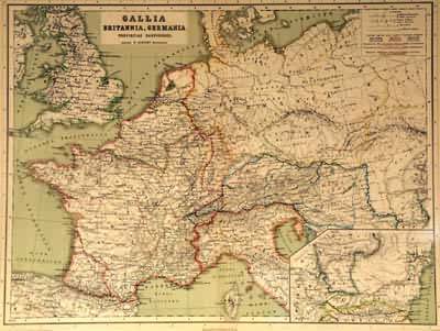
Gallia, Britannia, Germania
In stock
From Atlas Antiquus, Twelve Maps of the Ancient World for Schools and Colleges by Dr. Heinrich Kiepert, published in English with maps in Latin. This map shows Western Europe under the ancient Roman Empire. With an inset map of Dacia and Moesia (today parts of Romania and Bulgaria). This map also features exceptionally bright coloring.
Size: 17 x 13 inches
Condition: Excellent
Map Maker: Dr. Heinrich Kiepert
Coloring: Printed Color
Year: 1898
Condition: Excellent
Map Maker: Dr. Heinrich Kiepert
Coloring: Printed Color
Year: 1898
In stock


