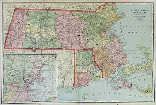
Massachusetts and Rhode Island
In stock
This map was made by George F. Cram for “Crams Modern Atlas” in 1905. In 1869 the George F. Cram Company was born and the Cram name quickly became synonymous with accuracy and innovation. This map illustrates Massachusetts and Rhode Island. Counties are outlined and highlighted in pastel coloring. Cities, towns, major transportation routes, and topographical features are noted.
Size: 20 x 13 inches
Condition: Very Good
Map Maker: George F. Cram
Coloring: Printed Color
Year: 1905
Condition: Very Good
Map Maker: George F. Cram
Coloring: Printed Color
Year: 1905
In stock


