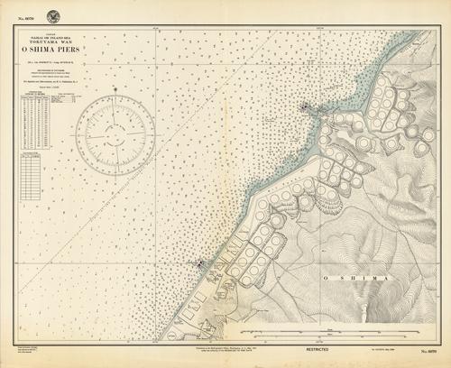
Japan- Naikai or Inland Sea- Tokuyama Wan- O Shima Piers
In stock
This coastal survey was printed by the U.S. Navy Hydrographic Office in Washington D.C in 1944. This map shows the eastern coast of O Shima Island, focusing on the piers used during WWII. Details include the structures on the pier, such as oil tanks and store houses. Depth soundings are shown in fathoms with a conversion chart from fathoms to meters.
Size: 26 x 20 inches
Condition: Good, age toning and staining
Map Maker: U.S. Navy Hydrographic Office
Coloring: Black and White
Year: 1944
Condition: Good, age toning and staining
Map Maker: U.S. Navy Hydrographic Office
Coloring: Black and White
Year: 1944
In stock


