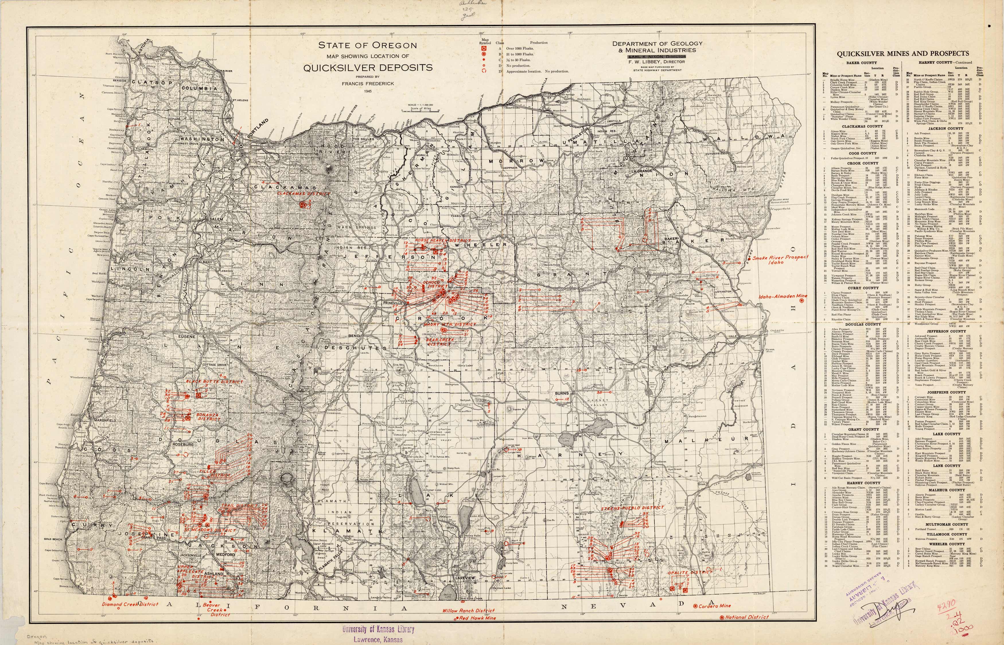
State of Oregon Map Showing Location of Quicksilver Deposits
In stock
This map of the state of Oregon shows the quicksilver deposit through each district. Published in 1945 by the Department of Geology & Mineral Industries. The key indicates the amount of the deposit in flasks. A chart lists the counties with all the mines and prospects and their locations.
Size: 32.5 x 20.25 inches
Condition: Very Good, library stamp University of Kansas Library, Lawerence Kansas
Map Maker: Department of Geology and Mineral Industries
Coloring: Printed Color
Year: 1945
Condition: Very Good, library stamp University of Kansas Library, Lawerence Kansas
Map Maker: Department of Geology and Mineral Industries
Coloring: Printed Color
Year: 1945
In stock


