

 |
||
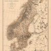
The Scandinavian Kingdoms. Norway, Sweden & Denmark.
Out of stock
This unique map of the Scandinavian Kingdoms (Norway, Sweden and Denmark), by A.K. Johnston, was created in 1876 for the “Historical Atlas of the World”. Johnstons maps represent a major departure from the standard appearance of maps from this time period. Countries, cities and towns, roads, rivers, and various geographic features are shown on this map. This would be a great addition for a map collector and/or an exceptional gift.
Size: 12 x 17 inches
Condition: Very Good, light age toning, light stains
Map Maker: A.K. Johnston
Coloring: Printed Color
Year: 1876
Condition: Very Good, light age toning, light stains
Map Maker: A.K. Johnston
Coloring: Printed Color
Year: 1876
Out of stock



