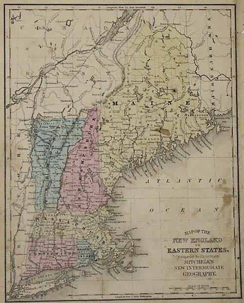
Map of the New England or Eastern States
Out of stock
This map was made by S. Augustus Mitchell for his Atlas entitled “Mitchell’s New Intermediate Geography A System of Modern Geography Designed For The Use Of Schools and Academies” published in 1863. The maps from this atlas were copper-plate engraved and hand colored. This is a map of the Eastern States, Maine, New Hampshire, Vermont, Massachusetts, Connecticut, and Rhode Island. Cities, towns, rivers, topographical features and railroads are illustrated. Small size, perfect for framing.
Size: 8 x 10.5 inches
Condition: Good- over all age
Map Maker: S. Augustus Mitchell
Coloring: Original Hand Coloring
Year: 1863
Condition: Good- over all age
Map Maker: S. Augustus Mitchell
Coloring: Original Hand Coloring
Year: 1863
Out of stock


