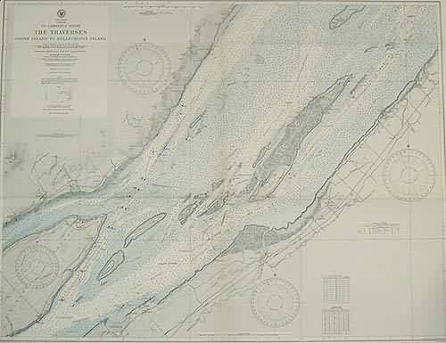
St. Lawrence River The Traverses Goose Island to Bellechasse Island
In stock
This coastal survey was stamped as completed on December 1943 by the U.S. Hydrographic department in Washington D.C. The St Lawrence River – The Traverses from Goose Island to Bellechasse Island is represented on this map. Cities, bays, ports and harbors are noted. These maps were used for off shore navigation only and were compiled from Canadian surveys between 1918 and 1919. Soundings are in fathoms, a conversion table showing fathoms to meters, and a chart with information on tides and tidal streams is included. Cites, railroads, streams, topographical features and islands are illustrated and noted.
Size: 42 x 32 inches
Condition: Excellent
Map Maker: U.S Hydrographic Office
Coloring: Machine Coloring
Year: 1944
Condition: Excellent
Map Maker: U.S Hydrographic Office
Coloring: Machine Coloring
Year: 1944
In stock


