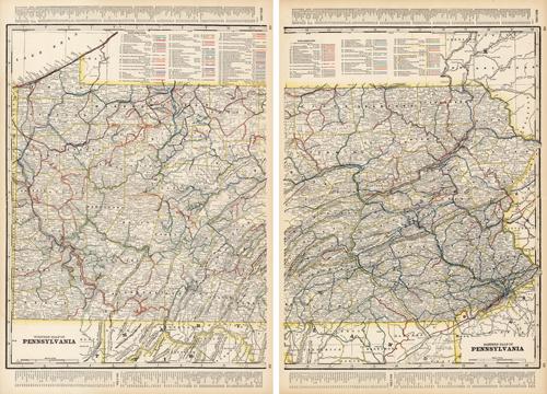
Western and Eastern Half of Pennsylvania
In stock
We at Art Source International are excited to offer these rare maps of Pennsylvania from George F. Crams 1898 “Standard American Railway System Atlas”. There are two maps being offered together, detailing the western and eastern half. These maps are exacting in its detail of railroad routes. All routes, down to the smallest spur line, are denoted in separate colors. Cram was one of the few mapmakers to update these maps yearly.
Size: 33 x 24.25 inches
Condition: Excellent
Map Maker: George F. Cram
Coloring: Lithographic Color
Year: 1898
Condition: Excellent
Map Maker: George F. Cram
Coloring: Lithographic Color
Year: 1898
In stock


